
|
Getting your Trinity Audio player ready...
|
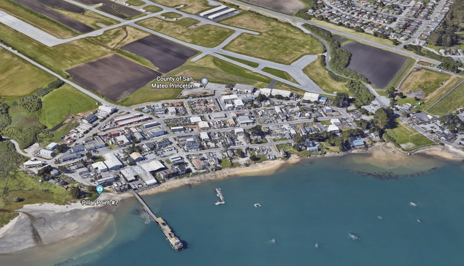
VIDEO and PRESENTATION. From San Mateo County Planning and Building‘s “Community Workshop for Draft Sea Level Rise Policies” on Tuesday, September 30th, 2025 from 10:00am to 12:00pm, as a hybrid meeting, to review the proposed approach to sea level rise in Plan Princeton with the establishment of a Sea Level Rise Overlay District. The presentation and a recording of the workshop are available below. Note that Plan Princeton area is located at Pillar Point Harbor.
The workshop was presented by Senior Planner, Summer Burlison and Bharat Singh, Planning Services Manager. SMCo Planning anticipates sharing a draft Princeton plan with the community in early 2026.
Topics Covered
- Preferred plan zoning.
- SLR overlay district and adaptation plan
- Cease development
- Relocation or removal
- Recorded deed restrictions
- SLR overlay real estate disclosures
- “Fair share” contribution for SLR improvements
- Transfer of development rights (TDR). Per Senior Planner, Summer Burlison, SMCo Planning presented TDR as an option to pursue after the adoption of the Plan Princeton Land Use Plan. An action item would be included in Plan Princeton for the County to establish this voluntary, implementable TDR program for property owners.


Plan Princeton Sea Level Rise Development Standards (September, 2025).
San Mateo County Plan Princeton webpage. Scroll down for “Meetings” and “Library” for documents.
More on Plan Princeton on Coastside Buzz
2013 Existing Plan Princeton Zoning Map

March 2015 Plan Princeton Preferred Land Use Plan Diagram
Note the change in Commercial zoning.

2024 Long Range Plan for San Mateo County Planning and Building

Plan Princeton Truck Routes 2015

Plan Princeton Coastal Access Plan 2015

Plan Princeton from the Midcoast Community Council (MCC) website

Project planner: Summer Burlison
Scope of Work
Public Participation Program
Coastal Act Background & Requirements
GOALS OF PLANNING UPDATE:
- Enhance coastal access, recreation, research, and education opportunities.
- Support and expand coastal-dependent and coastal-related uses.
- Provide facilities needed by the commercial fishing industry and recreational boaters.
- Create local jobs and services.
- Abate neighborhood blight and zoning violations.
- Address parking, circulation, and infrastructure needs.
- Identify and evaluate potential solutions to shoreline erosion problems.
- Protect and restore water quality and sensitive habitats.
- Maintain compliance with CA Coastal Act and State airport compatibility requirements.
MCC EARLY EFFORTS
- 2009 MCC and Pillar Ridge request for updated M-1 zoning regulations and Supervisor Gordon reply.
- 2012 MCC request/presentation to prioritize zoning updates for Princeton light industrial districts (M-1 and W).
- 2013 Pillar Point Harbor Shoreline Erosion MCC presentation
- 2014 MCC Overview Presentation on shoreline conditions, past and existing development, approved projects on appeal or not yet built
TIMELINE & PROGRESS OF PLAN PRINCETON:
2013 Community Visioning Report
2014 May: Existing Conditions Report
2014 Sept: Alternatives Workbook – comments by MCC — CCC
2015 Preferred Plan & Policy Framework – presentations to MCC – Planning Commission – comments by CCC — CGF —
comments on Development Standards Oct 2015 by MCC
>> 2016-2020 Project paused. <<
2017 – MCC requested status update — see 7/12/17 minutes #4a, although imminent roll out did not occur.
2019 Princeton Shoreline Management Plan – County policy framework memo to CCC & attachments — 2020 CCC reply: positive feedback on proposed water levels, erosion rates, and policy framework
Background
AIRPORT PLAN UPDATES
For info on 2014 updates of the Half Moon Bay Airport Land Use Compatibility Plan (ALUCP) and the HMB Airport Layout Plan, see Airport page.
ZONING ORDINANCES 2012
A-O Airport Overlay District
M-1 – light industrial District (airport & west of Airport St.)
W – Waterfront District – marine-related light industrial
CCR – Coastside Commercial Recreation District
ZONING MAPS
Midcoast Land Use Plan
Pillar Point & Marsh
Princeton
Harbor/Princeton Overview
LAND USE PLANS
Local Coastal Program (LCP)
>>> 1986 Princeton Area Study
Plan Princeton is a study being conducted by San Mateo County to update the land use plan for Princeton. The project will focus on the area west of and including Highway 1, between Pillar Point Harbor and Moss Beach. The purpose of this project is to make a comprehensive update to the policies, plans, and standards regulating the Princeton study area in order to:
- Enhance coastal access, recreation, research, and education opportunities.
- Support and expand coastal-dependent and coastal-related uses.
- Provide facilities needed by the commercial fishing industry and recreational boaters.
- Create local jobs and services.
- Abate neighborhood blight and zoning violations.
- Address parking, circulation, and infrastructure needs.
- Identify and evaluate potential solutions to shoreline erosion problems.
- Protect and restore water quality and sensitive habitats.
- Maintain compliance with the State Coastal Act and State airport compatibility requirements.

San Mateo County Plannning Commission
- VACANCY for Lisa Ketcham 2nd Term
Jan 01, 2023 to Dec 31, 2026
Representing Third District - Adam Nugent 1st Term
Aug 26, 2025 to Dec 31, 2027
Representing Second District - Andrei Garcia 1st Term
Jun 10, 2025 to Dec 31, 2028
Representing Fourth District - Carlos Serrano-Quan 2nd Term
Jan 01, 2025 to Dec 31, 2028
Representing Fifth District - Kumkum Gupta 3rd Term
Jan 01, 2025 to Dec 31, 2028
Representing First District
- Steven Monowitz
Community Development Director - CONTACT
Angela Montes, Commission Secretary
455 County Center, 2nd Floor
Redwood City, CA 94063
Phone: (650) 363-4161
E-Mail: planning_commission@smcgov.org