|
Getting your Trinity Audio player ready...
|
OWN VOICE. By Christine Boles, architect and Candidate for Pacifica City Council for District 2.
2-1/2 years ago I started reviewing a project known as Vista Mar that was to be built on a steep hill above my home on Monterey Road in Pacifica. I am a licensed architect and based on my 30+ years of experience, I would have expected our Planning Department to have required a thorough geotechnical report to make sure the project could be built safely before approving it. Nope – only two tests were done on the flat part of the site, right by the sidewalk instead of where the buildings were actually going to be built. Researching public records, I found a soils report from a previous project for this site by the same engineer. That report contained 12 borings on the hill and found 4 landslides, one of them noted as active. The city’s geotechnical engineer at the time required digging test pits to analyze the landslide risk further before even considering a project on this site. That project was abandoned with complaints by the applicant that the city’s engineer was too strict.
We neighbors pointed all this out to the Pacifica Planning Commission, and then to the City Council at our appeal hearing. We even hired our own experts but were ignored and the project was approved. We were so concerned about our safety that we sued the city. We knew the developer was responsible for paying the city’s legal fees, so we were not hurting the city.
We were recently vindicated, with the judge agreeing with us that we raised significant issues that trigger a more comprehensive environmental review process. The city tried to discredit me professionally, saying I was biased as I live near the project, but the judge soundly rejected their arguments, as well as their arguments trying to discredit our geological, hydrological, air quality and biology experts. The law is clear, when there are conflicting experts, an Environmental Report (EIR) is required.
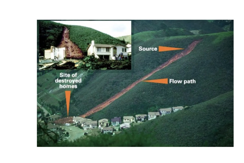
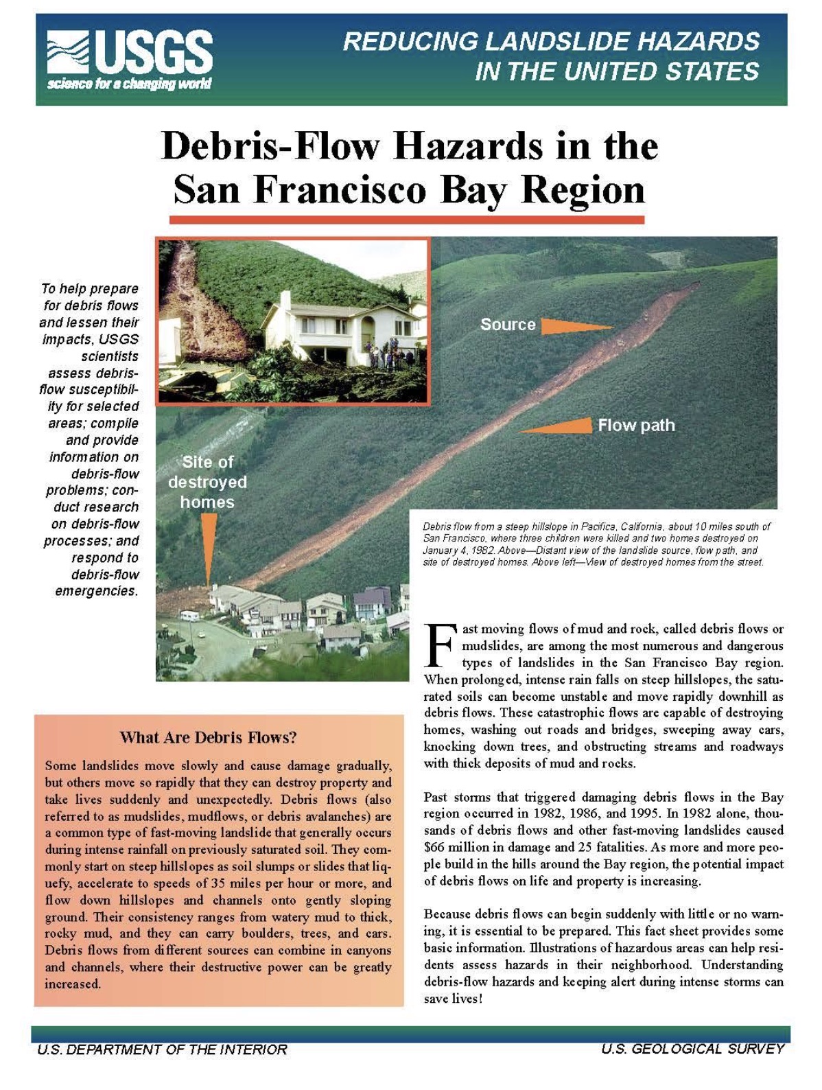
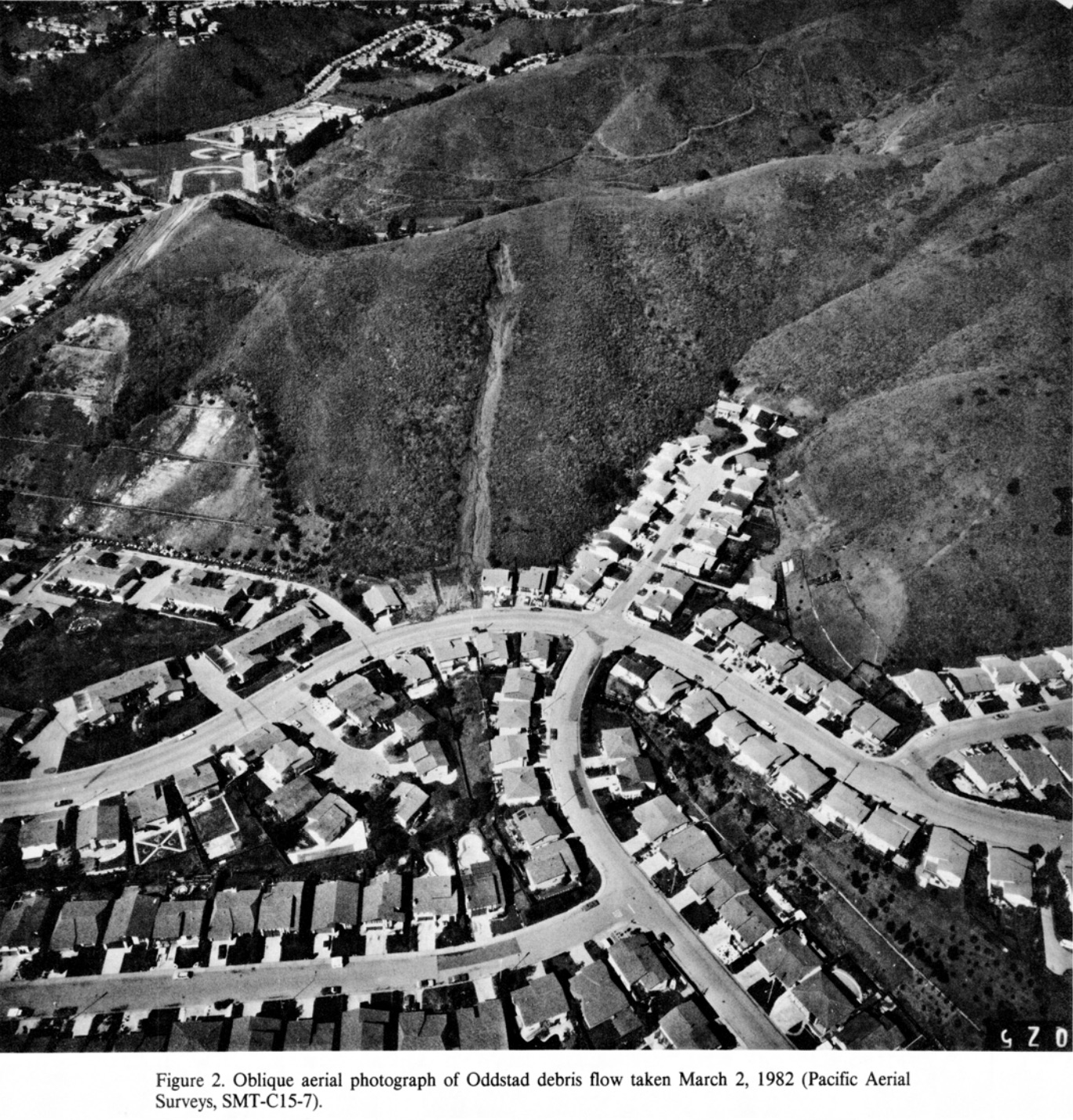
As part of my research for this project, I learned that Pacifica had experienced 475 landslides in 1982, including one on Oddstad Boulevard in Park Pacifica that killed three children asleep in their beds. Hundreds of properties were damaged, several destroyed. The city hired a geotechnical engineer, Howard Donley, in 1983 to study these landslides, and he wrote a report with detailed policy recommendations and called for new landslide maps to be drawn. More of these rain induced debris flow landslides happened in 1998 and 2016, and at least two more just this winter. The danger is still very present. In fact, Pacifica is USGS’s poster child for these types of landslides as shown below.
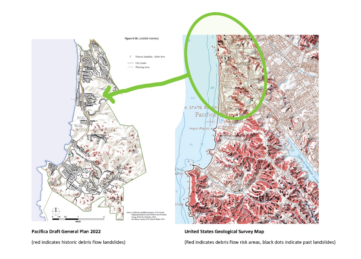
Fast forward 40 years and finally the city produced maps as part of the General Plan (GP)update. The first one lacked data on the north side of town. I pointed them to better data and was ignored. Then I spoke with the agency responsible for the data, the California Department of Conservation, and they agreed with me that this data set did not include us in Sharp Park, Manor, Edgemar, Westview or Fairmont.
At the Planning Commission hearing for the GP, Deputy Planning Director Murdock admitted the maps were incomplete, and said they were working on new maps. But the Planning Commission approved the GP anyway, oddly before even seeing the new maps…
New landslide maps were released about three weeks ago, just before the City Council’s first hearing on the General Plan. They are still wrong and are missing major landslides, even the recent one in 2017 that closed Highway One for almost an entire day.
I appealed the Planning Commission’s approval of the GP so that I could present the information visually to help everyone understand. Besides proper maps, I will also advocate for policies to be added to the General Plan, such as the need for geotechnical reports to study the hillsides above and below a project’s site boundaries, which is not typically done. Oddly, these policies were in our 1983 Safety Element that was completely revised after the 1982 events, but they are missing now.
The Planning Commissioners must be given the reports and tools they need to thoroughly review a project before it is approved. An accurate understanding of hazards is a very basic, critical part of what is needed. Just look at the development projects already in the pipeline in Pacifica, Pacifica Highlands across from the quarry, Linda Mar Woods, and who knows what at the end of Cape Breton. All of these are on sites with previous landslides and are in high fire danger areas.
And speaking of fire, longtime Pacifica resident Mark Hubbell is joining me in the appeal about fire issues. The fire map in the General Plan is blank in the city limits by the way. BLANK. The 2014 Draft General Plan fire map has much different information, and this information was adopted by the City Council as part of the new Local Coastal Land Use Plan in 2020. Now they’re trying to say it is not accurate…
Please tune in to the Pacifica City Council hearing on July 11 on zoom at about 5:30pm (there is one agenda item ahead at 5). Raise your voice, in written or oral comments and let the Council know that they cannot continue to ignore our basic safety.
Hopefully the City Council will listen this time as we argue for the safety of residents all over Pacifica.
Anatomy of a Debris Flow, Pacifica, California, January 4th, 1982
By Roy J. Shlemon, Geological Society of America, 1987.
[pdf-embedder url=”https://www.coastsidebuzz.com/wp-content/uploads/2022/07/RJS-PacificaAnatomyofaDebrisFlowRed.pdf”]



I’m so sad. I am just seeing this now. I would like to get involved.
Me too. Just saw this today.