

|
Getting your Trinity Audio player ready...
|
VIDEO. From the California Coastal Commission meeting on Thursday, July 10th, 2025 at 9:00am, as a hybrid meeting with remote comment. Agenda. Staff Report #16a (for information only). Location Maps, Site Area Maps, Commision-Adopted CDP 2-11-024 Report. Correspondence.
North Central Coast Deputy Director, Dan Carl, introduces CCC SF Staff, Julian Honey, presents.
Click for Video
Item #16a starts at 2:36:59
STAFF RECOMMENDATION. (1) Repair and expand 450 feet of an existing 2,600-foot long riprap revetment; (2) repair and expand an existing access road along the southern portion of the landfill area; (3) after-the-fact (ATF) approval for previous unpermitted expansion of the existing revetment; and (4) ATF approval for previous installation of fencing, expansion of gabion walls and relocation of a portion of an existing access road at the landfill site.
The proposed project is for repair and expansion of a 450-foot section of an existing 2,600-linear-foot riprap rock revetment, repair and expansion of an existing access road, installation of fencing and gabion walls and relocation of a portion of another existing access road, all at the Mussel Rock area of Daly City. The Mussel Rock site was formerly a shoreline landfill that is now closed and capped, and open and available for general public access via a system of trails and roads. These types of public access features were required by the Commission as part of the landfill closure in 1978, and the public access area known as Mussel Rock Park is now a significant recreational resource to the City and surrounding area.
The riprap revetment at the site, originally constructed in 1969, serves to contain the landfill, which lies directly inland of the revetment in an area of significant erosion and landslide activity and earthquake faults. There is limited beach, and the revetment essentially is located directly at the ocean’s edge where continuous tidal and wave action, along with more severe winter storm events, and in combination with site instability and episodic landslides, all contribute to undermine the structural stability of the revetment and the long-term stability of the landfill site.
Staff notes that this proposed project was heard at the Commission hearing in Chula Vista on July 13, 2012. At that time, the Commission heard public testimony regarding the proposed project, and ultimately the Commission continued the matter to the August hearing. At the hearing several Commissioners were interested in receiving additional detail and analysis related to the long-term future of the closed landfill site and the City’s proposed repairs and expansion to the existing revetment. Specifically, several Commissioners identified the need to develop a long-term solution to address the hazardous issues raised by the continued protection of the closed landfill, and wanted Staff to recommend more specific special conditions that require the City to consider options for managed retreat of the landfill, including a detailed feasibility study and cost assessment for relocation of both some portion of, and all of, the landfill.
In the time since that hearing, staff has worked with the City on such options, and is currently recommending a three-year temporary authorization and turn-around time to both address shorter-term stability issues that require immediate attention, and to allow for a thorough evaluation of the relocation option. The City has agreed to research the alternatives for future management of this site and submit a proposal for a Planned Retreat Management Plan in order to address the Commissioners’ concerns. In addition, if the City determines that managed retreat is not feasible in whole or in part, then it will provide this evidence to the Commission for consideration prior to the end of the three-year authorization period.
Staff’s recommended special conditions, which have been updated to address the concerns expressed by several Commissioners at the July 13, 2012 hearing, include limiting the permit authorization to three years and requiring the City to submit a Planned Retreat Management Plan within 1 year of Commission action (see Special Condition 8). Further, within 2 years of Commission action, the City must submit a permit amendment to either remove the revetment consistent with a Planned Retreat Management Plan or retain any portion of the revetment beyond the three-year period. Any proposal to retain any portion of the revetment beyond the three-year period of authorization must be accompanied by a specified alternatives analysis demonstrating the infeasibility of planned retreat for all of and part of the landfill.
Staff believes that the proposed armoring is an appropriate temporary solution because it is the least environmentally damaging feasible alternative available to stabilize the site while the City explores long term solutions that may be available to relocate the landfill, or portions of the landfill, and avoid the need for shoreline armoring. Therefore, at this time, the armoring work is necessary to avoid a situation where landfill materials could find their way into the ocean. Similarly, the related road, fence, and gabion development is necessary in this case to facilitate site stability and management operations as regulated by the Regional Water Quality Control Board (RWQCB). Further, impacts from the project can be appropriately offset through public access and public view enhancements at the site that build on those required through previous Commission actions, and through the limited three-year authorization period, during which the City will explore the long-term solutions available to relocate all of the landfill and portions of the landfill.
Thus, Staff recommends that the Commission approve a CDP for the proposed project with conditions designed to avoid coastal resource impacts and to limit and mitigate for those that are unavoidable, including conditions that require: 1) limiting this CDP authorization to three years; 2) meeting requirements for other agency approvals; 3) assumption of risk, waiver of liability and indemnity agreement for coastal hazards; 4) monitoring and maintenance of the revetment over the life of the project; 5) appropriate best management practices to protect water quality and public access during construction (for this project and for ongoing site maintenance); 6) analysis of long-term solutions and submittal of a Planned Retreat Management Plan; and 7) implementation of a Public Access Management Plan designed to enhance and facilitate public access and public views at the site, including through modified signage, fencing, and public access amenities.
Staff recommends approval of coastal development permit application 2-11-024 as conditioned.
The motion is found on page 5 below.
STAFF REPORT. The Mussel Rock Landfill, owned and managed by the City of Daly City, is a since capped and closed landfill located at the southern end of Daly City, directly north of Pacifica, in an area of high geologic instability running along the Pacific Ocean (see Exhibit 1). The capped landfill area is currently used as a park (Mussel Rock Park) and is designated by the City’s Local Coastal Program for open space and public access. The area is actively used by the public, with surveys showing about 100 visitors per day who pursue recreational activities such as hiking, sandy beach access, dog walking, fishing, and hang-gliding. The site is served by a public parking lot located at the southern end of the site (at the end of Westline Drive, next to a former solid waste transfer station) through a pedestrian gate, and includes a series of crisscrossing roads and paths used by the public, including a compacted maintenance road that runs along the top of the entire length of a revetment that fronts the site (see photos of the area in Exhibit 2).
The landfill at Mussel Rock opened in 1957 as a Class III (i.e., general, and nonhazardous waste) municipal landfill serving the Cities of Daly City and Pacifica, where it operated for twenty years until it was closed by order of the Regional Water Quality Control Board (RWQCB) in 1978. The primary issue with the site is that it is located at a confluence of serious hazards that significantly undermine its stability, including not only erosion, landslides,2 and storm/wave action, but also seismic activity, where the landfill is located at roughly the point where the San Andreas Fault makes landfall south of San
Francisco. As a result, the site is subject to significant coastal hazards, which leads to substantial regular, ongoing, and costly maintenance, monitoring, and remediation needs. While this kind of hazardous site would be problematic for any number of developments and uses, it is particularly problematic when the site includes over a million cubic yards of solid waste immediately adjacent to the Pacific Ocean.
To ‘hold in’ and contain the landfill materials, an approximately 35-foot high and roughly half-mile long riprap revetment fronting the site was built as part of RWQCB requirements back when the landfill was in operation, as garbage was being washed into the ocean due to instability. That revetment exists in largely that same form today (albeit modified and expanded, see further below), and continues to be the City’s chosen method to contain the landfill, prevent landslides, and control waste and contaminated runoff from the site from entering the ocean. As might be expected given the armoring has been present at this location for over 50 years, limited sandy beach area remains seaward of the revetment, and the revetment is essentially located directly at the ocean’s edge where continuous tidal and wave action, severe winter storm events, site instability, and episodic landslides all combine to destabilize both the
revetment and the overall site.
The Coastal Commission’s involvement at the site began in 1978 when it issued a CDP that authorized capping the landfill (CDP P-77-182), installing trails and other public access amenities atop the capped landfill, implementing other related closure activities, and constructing a new solid-waste transfer station at the southern part of the site, all intended to meet RWQCB closure requirements. Ultimately, the City found itself in violation of that CDP when the required public access improvements were never
initiated, and the City also violated the Coastal Act when it continued to undertake development at the site to comply with RWQCB requirements (to manage drainage and reduce the risks of landslides and daylighting waste, including revetment modifications), without a CDP. Ultimately, it wasn’t until some 25 years later that the City pursued another CDP, when problems with the revetment in the early 2000s required remediation and the Commission authorized the repair and expansion of a 50-foot section of the revetment and a roughly 150-foot section of gabion retaining wall above that in 2002 (CDP 2-01-011). In any case, after development was completed pursuant to that CDP, the City continued to modify and augment the revetment without a CDP for the next decade.
In 2012, the Commission authorized the past revetment work done without CDPs afterthe-fact, as well as new revetment and access road development (CDP 2-11-024; see Exhibit 3). By this time it was clear that the site was becoming even more problematic, which raised concerns that either an episodic event and/or gradual destabilization was going to lead to significant trash and related materials finding their way to the beach and into the ocean. Additionally, Commissioners and staff expressed a strong concern that there was no comprehensive plan to address the problem, including where the revetment had proven to need relatively constant augmentation, and was continuing to lead to significant coastal resource impacts, including a direct and ongoing loss of beach. At that time, the Commission wanted additional detail and analysis related to the long-term future of the landfill site and the revetment; identified the need to develop a long-term solution to address the issues raised by the continued protection of the closed landfill; and required the City to consider options for planning for retreat of the landfill, including a detailed feasibility study and cost assessment for relocation of some or all of
the landfill and restoration of the site.
Thus, that CDP limited the armoring authorization to three years (until 2015) and required that a Planned Retreat Management Plan (PRMP) be submitted for review and approval by the Executive Director by 2014. The PRMP was required to fully evaluate potential relocation of the landfill, removal of the revetment, remediation and restoration of the site, potential constraints (including geotechnical and engineering constraints), potential phasing options and timelines, estimated project costs, and potential funding sources. Ultimately, that CDP required the City to come back to the Commission for a CDP amendment to implement the Executive Director-approved PRMP, where the intent was to foster landfill relocation, revetment removal, and site restoration as much as possible unless conclusively demonstrated to be infeasible. Ultimately, although the City has submitted multiple iterations of PRMPs over the years (including a revised edition last year), such PRMPs not been sufficient to meet the CDP requirements and have been returned to the City by the Executive Director with direction regarding what
needs to be modified to allow for Executive Director review and approval.
In the interim, the revetment authorization under the Commission’s 2012 CDP approval expired in 2015, and thus the revetment has been unauthorized for ten years (while the authorization for other improvements in the permit remain). Although currently out of compliance with the deadlines established for the PRMP, lack of compliance does not alleviate the need for such a plan, and the PRMP is in fact still required by the CDP. At the same time, conditions at the site have continued to deteriorate, and the Commission has issued five emergency CDPs (ECDPs), including two this year alone, to continue to
address ongoing and active landslides, and to prop up the revetment at the site.
Within this framework, staff notes two things. First, the site is extremely problematic and will likely only become more so as coastal hazard risks intensify, including considering rising sea levels. Further, it is not clear that continued landslide remediation and revetment augmentation at the site will be sufficient – or even possible to a certain extent – in the longer run to contain the landfill in situ, nor whether that is the best public policy and coastal resource option for this site. As is, the landfill continues to sporadically shed trash onto the beach and into the ocean, and the RWQCB requires active monitoring for leachate, which continues to be a significant concern. Staff believe that the former landfill site poses a severe threat to marine resources, especially due to its hazardous location along the coast, and are concerned about the risk of a catastrophic failure, driven by any one, or a combination of, the various hazards that
exist here. In addition to the landfill and hazard issues, the site is also culturally sensitive, but such cultural resources have not been effectively addressed either.
Second, given that context, staff believes that it is critical that the City complete the PRMP process, and that the Commission takes action to require implementation of the PRMP, all as was envisioned in the 2012 CDP. Critical decisions about the future of the site have been left unanswered, leading to ongoing resource degradation and the lack of a long-term plan. Thus, staff intends to bring the City’s PRMP – in whatever form it is in at that time8 – to the Commission as a condition compliance item later this year.
Although the PRMP was originally structured by the 2012 CDP to come back for Executive Director review and approval, the Executive Director believes it is prudent that a decision of this magnitude be something that the Commission as a body weighs in on.
For several reasons, including because of its somewhat overlooked location, the above described issues surrounding the Mussel Rock site have been under the environmental radar. In staff’s view it will be important to raise its profile in the public arena, as a major remediation project that proposes the removal of material of this magnitude would be quite expensive and would require partnerships and engagement at all levels. Such a process is critical in this case so that more awareness is brought to what is a serious
environmental problem, but also so that such awareness can help to spark action.


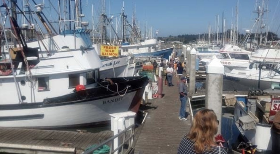
Half Moon Bay has a Dump, aka Landfill, that also Needs Remediation
More on the Half Moon Bay City Council on Coastside Buzz
Half Moon Bay City Council Meetings ~ 1st & 3rd Tuesdays @ 7:00pm
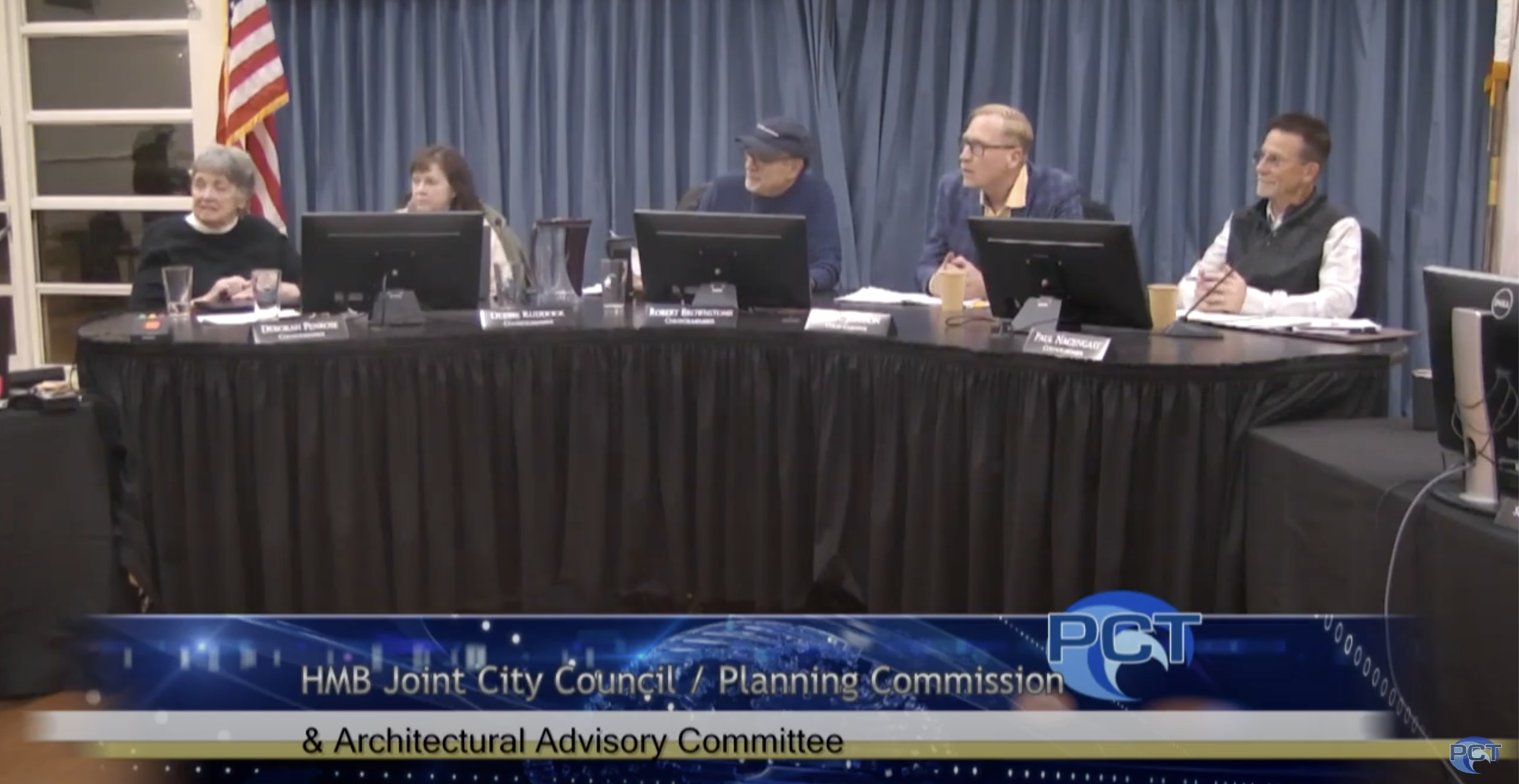
The City Council of Half Moon Bay is the City’s governing body, and consists of five elected members. The Council sets priorities and policies, makes final decisions on all major City matters, adopts ordinances and resolutions, appoints the City Manager and City Attorney, and approves the annual budget.
The Half Moon Bay City Council typically meets on the first and third Tuesday of each month starting at 7:00pm at the Ted Adcock Community Center, 535 Kelly Avenue.
HMB City Council Agendas and Zoom Links
Regular meeting agendas are posted 72 hours in advance.
Special meeting agendas are posted 24 hours in advance.
– Streamed live on Comcast Channel 27 and Pacific Coast TV website
– Facebook Live in English: City of Half Moon Bay FB Page
– Facebook Live in Spanish: City of Half Moon Bay Recreation FB Page
Comments in accordance with the three-minute per speaker limit. The City Clerk will read all comments into the record. Please visit our “Commenting at a City Council Meeting” information page.
– Email Maggie Rodriguez, Assistant City Clerk, at MRodriguez@hmbcity.com prior to or during the meeting
– Facebook live during the meeting
– Phone during the meeting: (650) 477-4963 (English) and (650) 445-3090 (Spanish)
Archived HMB City Council meeting videos on PCTv
Subscribe to HMB’s Agendas, Weekly eNews, Project Updates, City alerts, Calendar Events, Bid Postings.
You can also learn about City Council Procedures and Decorum.
The City Council develops Strategic Elements to help focus the City’s actions and work plans on its key priorities.
Do You Know How the 1953 Brown Act Guides Public Agencies Towards Transparency?
City Council Contact
Phone: (650) 726-8250 (leave message with Clerk’s office)
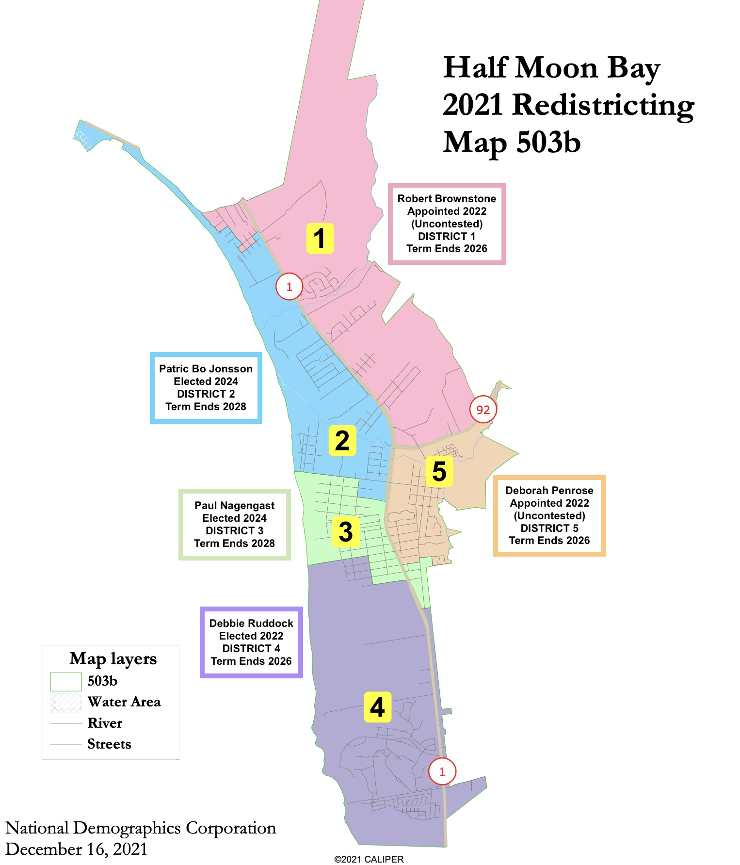
Mayor Robert Brownstone, District 1; Term ends 2026
RBrownstone@hmbcity.com
Vice Mayor Debbie Ruddock, District 4; Term ends 2026
DRuddock@hmbcity.com
Councilmember Deborah Penrose, District 5, Term ends 2026
DPenrose@hmbcity.com
Councilmember Patric Bo Jonsson, District 2, Term Ends 2028
PJonsson@hmbcity.com
Councilmember Paul Nagengast, District 3; Term Ends 2028
PNagengast@hmbcity.com
The City of Half Moon Bay holds district-based elections for its five city council seats. Each Councilmember is elected to a 4 year term. There are no term limits in Half Moon Bay. The City Council selects one of its members to serve as Mayor and one to serve as Vice Mayor, on an annual basis.
- November 2024 Election – Districts 2 and 3 will elect a representative to a four-year term.
- November 2026 Election – Districts 1, 4, and 5 will elect a representative to a four-year term.
Click here to figure out which district you are in. Type your address into the interactive map and it will show you which district you are in.


Author: mdrag
x