|
Getting your Trinity Audio player ready...
|
SURVEY and INTERACTIVE MAPS.
CalTrans Active Transportation Plan Survey; Walking and biking near and along State Routes.
Your opinion matters. Have 5 minutes to spare?
Your survey response will help Caltrans plan for biking and walking near you. Please click through the following screens to identify concerns that you believe need to be addressed to improve walking and biking on and along State Routes near you.
 By clicking “Let’s get started” you confirm that you read and agree to the disclaimer and voluntarily agree to participate.
SURVEY ~ Let’s get started!
DRAFT SUMMARY REPORT for Caltrans District 4 Pedestrian Plan for the Bay Area
STORY MAPS. Caltrans District 4 Pedestrian Plan for the Bay Area DRAFT as of January, 12th, 2021.
Welcome to the Caltrans District 4 Pedestrian Plan for the Bay Area! This Story Map is an interactive way to view existing conditions and needs for people walking in District 4, which covers the nine-county Bay Area region. We encourage you to use this map to view conditions and needs in your community. The Pedestrian Plan’s main output is a prioritized list of location-based pedestrian needs, which are mapped on this site.
The Caltrans statewide plan, Toward an Active California, envisions that by 2040 people in California of all ages, abilities, and incomes can safely, conveniently, and comfortably walk and bicycle for their transportation needs. This Plan aligns with that vision by identifying needs on, across, and parallel to the State Highway System. It is guided by the four goals in Toward an Active California:
- Mobility: Reduce dependency on vehicles by shifting trips to biking, walking, and transit.
- Safety: Facilitate safe travel for everyone, regardless of age, ability, and how they travel.
- Equity: Improve accessibility and healthier transportation options for disadvantaged communities.
- Preservation: Address long-term maintenance needs and resources so highways remain in good repair.
This Story Map is a companion to the Pedestrian Plan Summary Report, a more detailed written document that is available on the D4 Pedestrian Plan page at the Caltrans Active Transportation Plans website.The Summary Reportincludes background about this project, its process, and next steps for meeting the needs of people walking in the Bay Area. This Plan uses the terms pedestrian and walking broadly to include people of all ages and abilities, including those walking and those using assisted mobility devices like wheelchairs.
Existing conditions
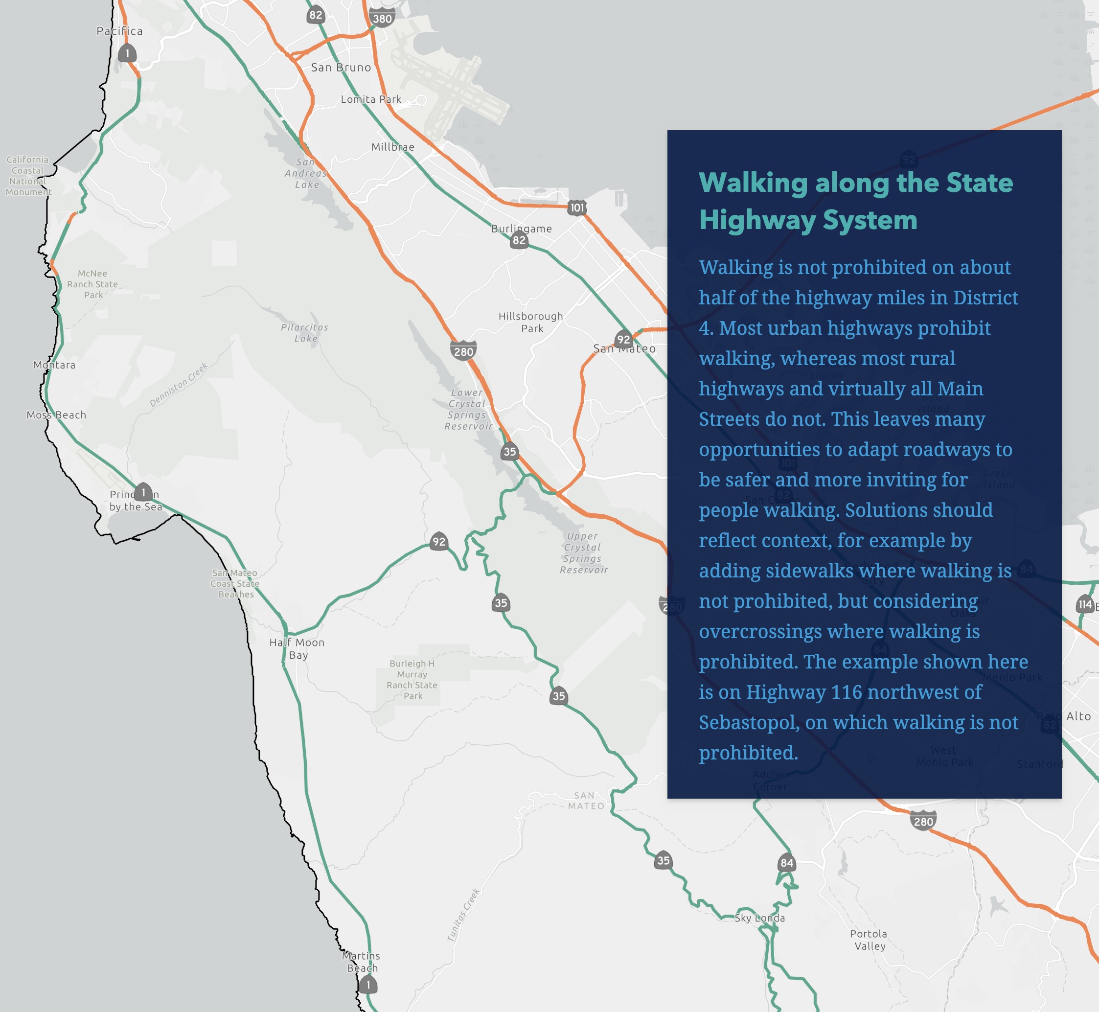
The following maps detail general conditions of the State Highway System, the network of roadways across the district operated by Caltrans. Results of the full detailed analysis of state highways in the District is captured in the Existing Conditions Report, an interim document that complements this Pedestrian Plan, and which is available on the District 4 page of the Caltrans Active Transportation Plans website. This section summarizes the key highlights from that report.
See this Explore map for additional existing conditions measures.
Next steps
Coordination with those partners is essential to ensure projects successfully meet the needs of people walking on Caltrans roadways. Local partners and the public can contact their District 4 Complete Streets Coordinator for more information about local projects in their communities, to provide input, and to coordinate on project development and implementation. Your Complete Streets Coordinator is:
QUESTIONS: Sergio Ruiz // sergio.ruiz@dot.ca.gov

Caltrans Bike Highway Study
About
Caltrans Bay Area (District 4) manages nearly 1,400 miles of State Highway corridors throughout the Bay Area. The goal of this Study is to understand where Bike Highways may be installed alongside State Highway corridors.
The Study builds off of the recommendations included in the 2018 Caltrans District 4 Bike Plan and the 2017 California State Bicycle and Pedestrian Plan, Toward an Active California.
What is a Bike Highway?
A bike highway is a high-quality, uninterrupted, long-distance bikeway that reduces barriers to destinations that people want to
travel to and from, especially places which may normally be difficult to bike to. Bike highways may consist of a mix of on-street facilities and fully-separated trails and should be designed so as to accommodate people of all ages and abilities riding bikes, as well as people walking and rolling where appropriate and feasible. For this Study, Caltrans is evaluating bike highways parallel to State highway corridors.


