|
Getting your Trinity Audio player ready...
|
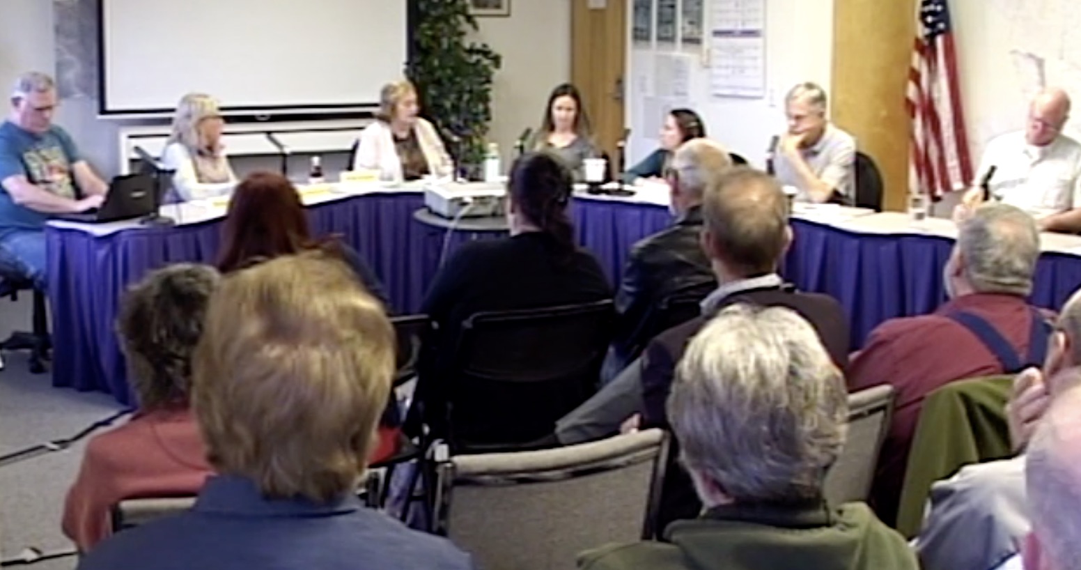
VIDEO. From the Sewer Authority Mid-Coastside (SAM) Director’s meeting on September 26th, 2022 at 7:00pm by Zoom.
SAM Chair Debbie Ruddock (also Mayor of the City of Half Moon Bay) acknowledges fellow SAM Director, Kathryn Slater-Carter (also Montara Water and Sanitary District) to report out.
Slater-Carter attended a meeting earlier in the day that was hosted by OneShoreline.
The San Mateo County Flood and Sea Level Rise Resiliency District, also known as OneShoreline, is an independent government agency that works across jurisdictional boundaries to secure and leverage public and private resources for the long-term resilience of our region. We plan and build solutions to the climate change impacts of sea level rise, flooding, and coastal erosion, and enhance the environment, recreational opportunities, and quality of life within communities throughout the county.
Conflict arises over harbor breakwater in San Mateo County
Harbor District, OneShoreline eye plans for addressing coastal erosion
Sierra Lopez Daily Journal staff ; Sep 27, 2022

OneShoreline Pillar Point Harbor Area Shoreline Management Study
Pillar Point Harbor and the surrounding northern Half Moon Bay coastline is a rehttps://oneshoreline.org/projects/pacific-coastline-projects-in-development-with-other-partners/creation epicenter on the San Mateo County coast for both local and non-local outdoor enthusiasts. The shoreline trails and beaches in this area are used by a diverse cross-section of community residents for kayaking, coastal access, walking, and bird watching. Key destinations include the iconic Mavericks surfing location that attracts big-wave surfers from around the world, Surfers Beach, and Miramar Beach in Half Moon Bay. Significant coastal access corridors – State Route 1 and the California Coastal Trail – back these beaches. In addition, this reach of coastline is home to important ecological assets, including Pillar Point Marsh, which serves as habitat for threatened species and species of concern. Bird enthusiasts have sighted nearly 20% of all North American bird species in this 66-acre protected salt marsh.

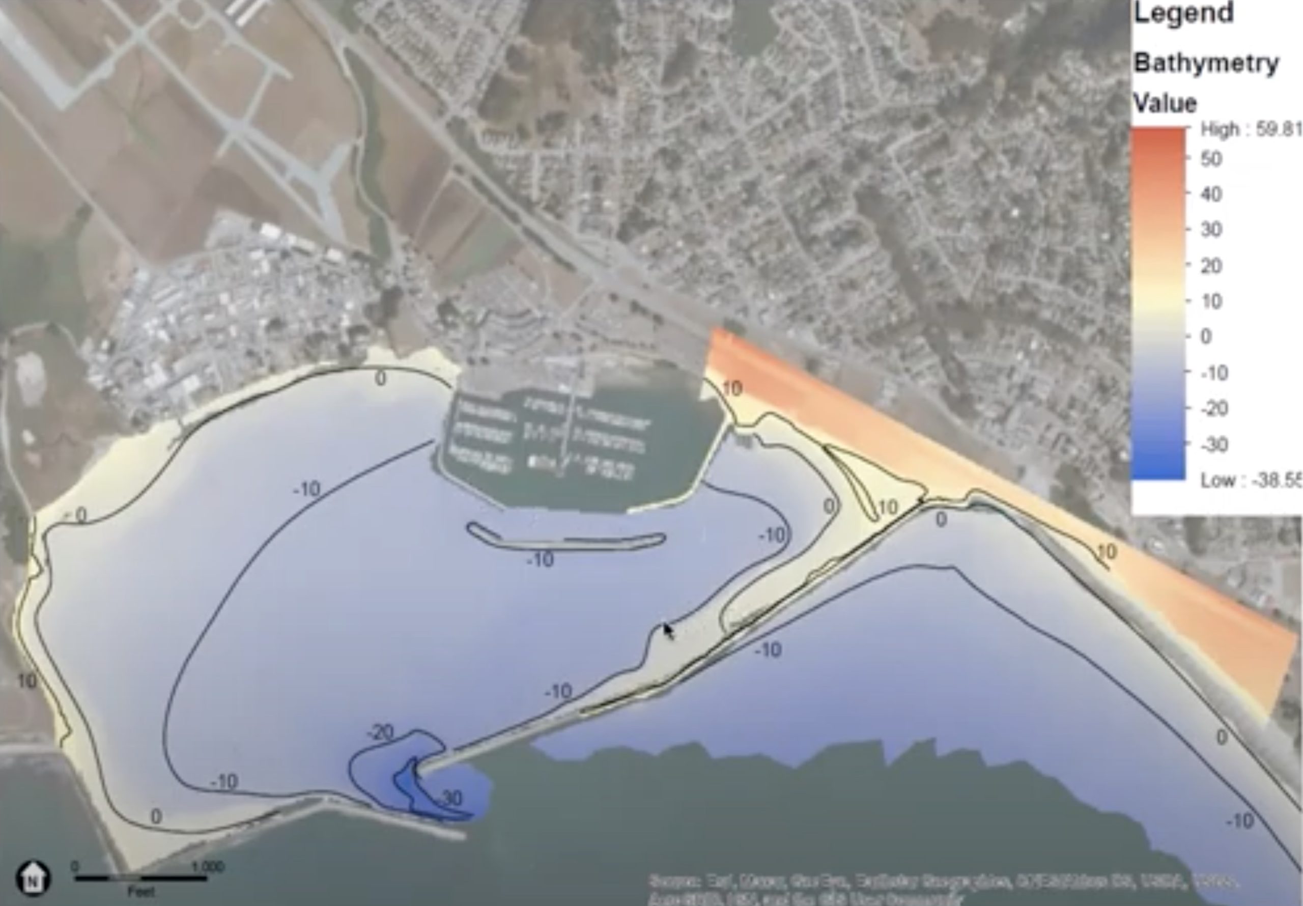
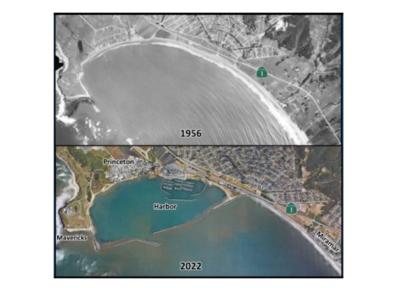
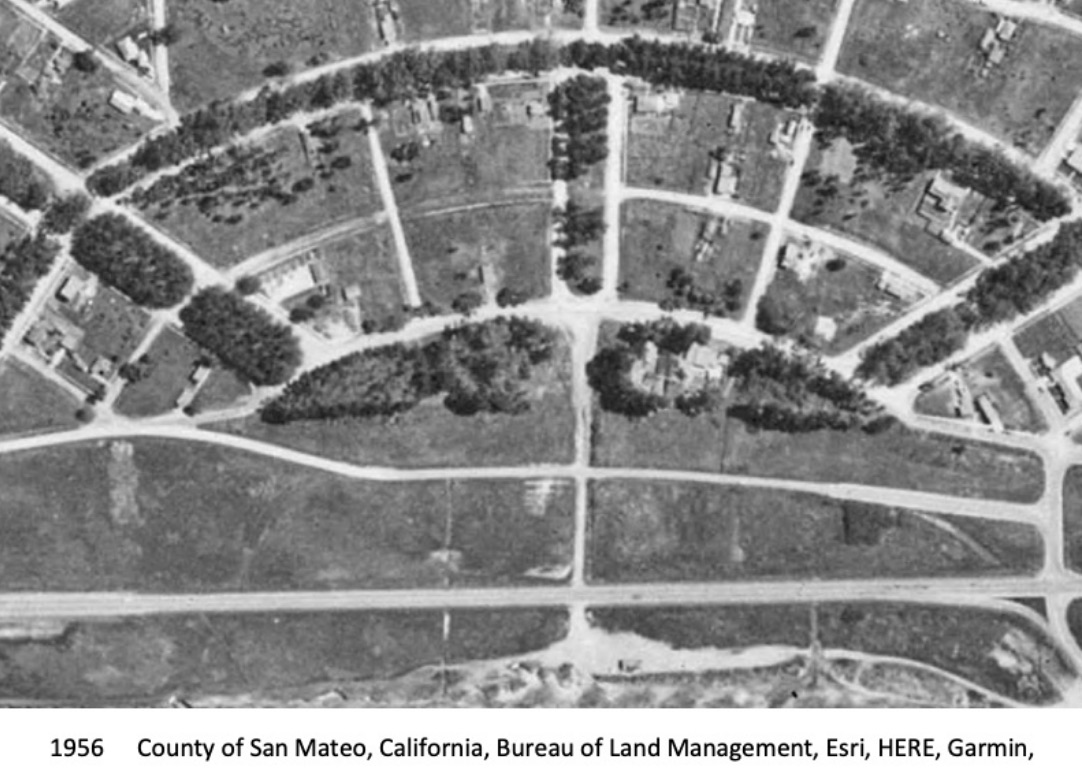
This region faces serious ongoing coastal erosion issues, dating back to the construction of breakwaters in the early 1960s by the U.S. Army Corps of Engineers to protect Pillar Point Harbor and community of Princeton-by-the-Sea (Princeton). Following the construction of the outer breakwaters, rates of coastal erosion both within the Harbor and along the shoreline directly south of the east breakwater dramatically increased, retreating at a rate over 7 times greater than the rate of erosion before the breakwater in some areas of the Princeton shoreline. The evolution from a smooth, continuous sandy coastline to an eroded bluff or hardened shoreline can be clearly seen in historical aerial photography.


Current rates of erosion will only be exacerbated with sea level rise and climate-driven storms. The 2018 San Mateo County Sea Level Rise Vulnerability Assessment found that State Route 1 at Surfer’s Beach, as well as Mirada Road to the south, are compromised and extremely vulnerable to sea level rise. In addition, vulnerable unincorporated communities such as Princeton face critical flooding threats, with one-third of its population and land area projected to be inundated during a 100-year event and six feet of sea level rise.
A series of past and ongoing projects have been developed to address these issues on certain shoreline reaches. From 2010 to 2016, the U.S. Army Corps of Engineers prepared several documents and studies to determine the feasibility of a project to mitigate the impacts of the Pillar Point Harbor breakwaters, including renourishment of Surfers Beach, and ultimately concluded that such a project does not have a federal interest. More recently, the San Mateo County Harbor District has led the West Trail Living Shoreline Project to stabilize the popular recreational trial that serves as access to Mavericks Beach and the harbor’s west breakwater. The Harbor District is also implementing the Surfers Beach Restoration Pilot Project, which involves a one-time placement of sand that been trapped inside the breakwaters. Meanwhile, San Mateo County is leading an effort to update land use policies to provide a sustainable direction for future development along the Princeton shoreline (Plan Princeton), and has also evaluated solutions to stabilize Mirada Road and the Mirada Road pedestrian bridge. While various project-specific studies have recognized the erosion concerns in this area due to the breakwaters, no comprehensive erosion modeling has been performed in and around the harbor and no meaningful progress can proceed without this baseline understanding of current conditions.
The San Mateo County Flood and Sea Level Rise Resiliency District (OneShoreline) is currently working to define a comprehensive shoreline management approach that takes a holistic look at this complex landscape in two ways:
- In terms of geography, the current project scope looks at the northern Half Moon Bay shoreline from Mavericks Beach to the Mirada Road bridge.
- In terms of time scale, this work is focused on addressing the impacts of coastal erosion and sea level rise in the long-term: to protect the community from the current FEMA 100-year floodplain plus approximately 6 feet of sea level rise, taking in account accelerating shoreline erosion rates.
OneShoreline has engaged a consultant to leverage the information gathered from past efforts and define alternatives in the context of these holistic objectives. The daunting extent of these impacts demands a bold approach that keeps all options on the table, and while all alternatives will be considered at the initial planning stages, nature-based solutions are preferred. Ultimately, any final strategy will require substantial input from and close partnership with the key governmental and non-governmental stakeholders in the project area.
One Shoreline History

Several efforts to address flooding, sea level rise and coastal erosion in San Mateo County are already underway.
In 1959, State legislation established the San Mateo County Flood Control District to address flooding challenges in several specific flood prone areas called “flood zones.”
In 2015, the County’s Civil Grand Jury issued a Report, “Flooding Ahead: Planning for Sea Level Rise,” that posed the question: What actions can the County of San Mateo, and the 20 cities and two relevant local special agencies within the county, take now to plan for sea level rise?” It answered this question by recommending “that a single organization undertake SLR planning on a countywide basis.”
In 2016, the County’s Department of Public Works established a Flood Resilience Program that developed a Memorandum of Understanding (MOU) to plan three potential projects: Bayfront Canal/Atherton Channel (MOU with Menlo Park, Redwood City, and Atherton); Belmont Creek (MOU with Belmont and San Carlos); and Navigable Slough (MOU with San Bruno and South San Francisco).
March 2018, the City/County Association of Governments (C/CAG) convened the “Floods, Droughts, Rising Seas, Oh My!” water summit, bringing together regional experts and policy-makers to discuss San Mateo County water management challenges and opportunities. There, Congresswoman Jackie Speier identified the need for a countywide agency to address the challenges of flooding, sea level rise and coastal erosion. This agency would allow San Mateo County and its 20 cities to: 1) coordinate the planning and implementation of projects across jurisdictional lines, which enables uniform levels of protection and the sharing of technical information and resources, and 2) create a broad and unified vision and voice that would position the new regional agency and its projects to obtain funding and regulatory permits.
In April of 2018, the City/County Association of Governments of San Mateo County (C/CAG) Countywide Water Coordination Committee began to develop a proposal to form a countywide agency to address sea level rise, flooding, coastal erosion, and regional stormwater infrastructure. After analyzing various potential approaches to the agency, the Water Coordination Committee recommended that new State legislation expand the mission, geographic reach, and governing Board of the 1959 San Mateo County Flood Control District. This legislation, Assembly Bill 825 (Mullin), was signed into law in September 2019, and on January 1, 2020, the San Mateo County Flood and Sea Level Rise Resiliency District was born.
More on SAM and Flood Hazards
Sewer Authority Mid-Coastside (SAM) Meetings ~ 2nd & 4th Mondays @ 7:00pm
Watch remotely. Comments and questions by email.
Agendas and Zoom Links
SAM Meeting Videos via Pacific Coast TV
Contact Us
Our regular office hours are 7:00 a.m. through 4:00 p.m., Monday through Friday, excluding holidays.The Authority can be reached 24-hours a day at:
(650) 726-0124
Our Mailing Address is:
Sewer Authority Mid-Coastside
1000 Cabrillo Hwy N.
Half Moon Bay, CA 94019

Yellow = cancelled SAM meeting due to Holidays
(650) 726-7833 (fax)
Regular Board Meetings are on the 2nd and 4th Mondays of each month at 7:00pm.
From time to time a meeting date may be changed, cancelled or relocated. Check the posted agenda for any changes to the normal schedule (click on links below).
The Sewer Authority Mid-Coastside (SAM) provides wastewater treatment services and contract collection maintenance services for a population of approximately 27,000 in the following areas:
- City of Half Moon Bay
- El Granada
- Miramar
- Montara
- Moss Beach
- Princeton by the Sea
SAM Directors
Barbara Dye
Chair, Representing Granada Community Services District
Deborah Ruddock
Vice-Chair, Representing the City of Half Moon Bay
Kathryn Slater-Carter
Secretary/Treasurer, Representing Montara Water and Sanitary District
Dr. Deborah Penrose
Director, Representing the City of Half Moon Bay
Ric Lohman
Director, Representing Montara Water & Sanitary District
Matthew Clark
Director, Representing Granada Community Services District
Powerpoint Tour of the SAM Plant
Courtesy of Tim Costello, SAM
Click on Date


