|
Getting your Trinity Audio player ready...
|
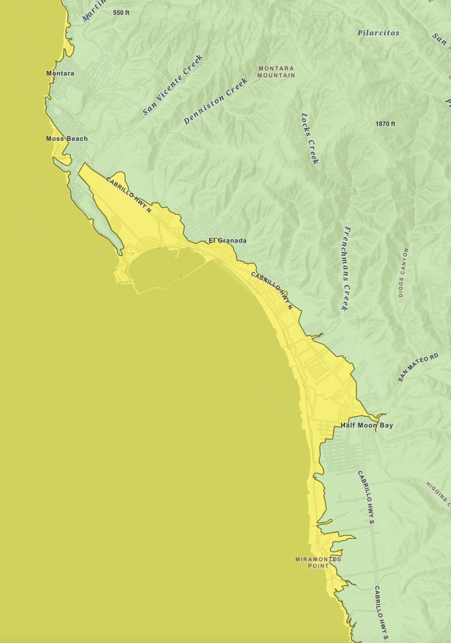
MAP. From the California Department of Conservation Interactive Tsunami Hazard Area Map.
California Department of Conservation for California Tsunami Maps
The Tsunami Hazard Area (shaded yellow on map) was prepared to assist cities and counties in identifying their tsunami hazard for tsunami response planning. The hazard area represents the maximum considered tsunami runup from several extreme, infrequent, and realistic tsunami sources. These data are intended for local jurisdictional, coastal emergency planning uses only.
This map, and these data and the information presented herein, is not a legal document and does not meet disclosure requirements for real estate transactions nor for any other regulatory purpose. Tsunamis are rare events; due to a lack of known occurrences in the historical record, this map and these data include no information about the likelihood of any tsunami affecting any area within a specific time period.
The Tsunami Hazard Area Map was compiled with the best currently available scientific information and represents an area that could be exposed to tsunami hazards during a tsunami event. It is primarily based on inundation limits corresponding to a 975-year average return period tsunami event model. These limits have been extended to reflect potential local tsunami sources not considered in probabilistic analysis and are also modified to reflect the practical need to define limits that coincide with geographic features or city streets.

