|
Getting your Trinity Audio player ready...
|
PRESS RELEASE. From San Mateo County Executive’s Office regarding Supervisor Mueller’s Post-Tsunami Warning Response Meeting at Mavericks House on Thursday, December 19th, 2024 at 6:00pm.
Half Moon Bay – Local emergency officials vowed Thursday to quickly address gaps in tsunami warning and response procedures and to hold drills routinely.
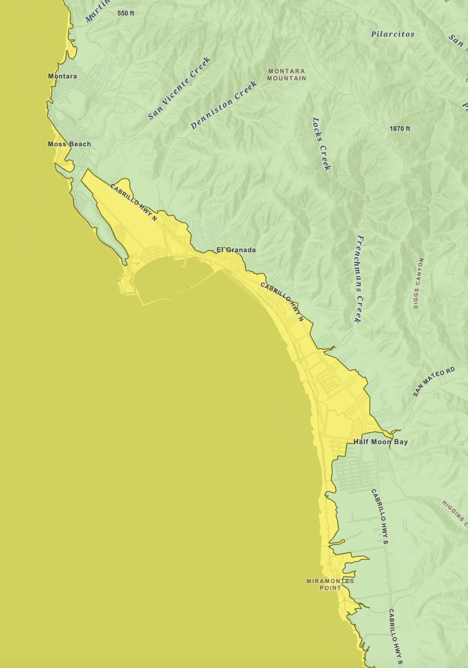
Clearly defining terms such as “high ground” and marking evacuation routes are among the assignments for the San Mateo County Department of Emergency Management in the aftermath of the Dec. 5 tsunami warning by the National Weather Service. Officials also pledged to launch a public education campaign about tsunami risks that include how to create a basic family safety plan.
“These are the things we will be working on in the coming months,” Dr. Shruti Dhapodkar, director of the County’s Department of Emergency Management, told about 75 residents at a forum in Half Moon Bay on the local tsunami response. “Every year we need to practice.”
San Mateo County Supervisor Ray Mueller, whose district includes the affected coastal areas, convened the forum to bring together residents and local emergency managers to share lessons learned on Dec. 5.
“The one thing I want to let you know up front,” Mueller said as he opened the meeting, “is that the team you see assembled here in front of you has been working tirelessly since that day … trying to figure out how we can go ahead and prepare for that next event.”
In addition to Mueller and Dhapodkar, local officials responding to questions included representatives from the San Mateo County Sheriff’s Office, CAL FIRE CZU, the cities of Pacifica and Half Moon Bay and other agencies.
Several members of the audience said they were confused and alarmed on the morning of Dec. 5 when cell phones buzzed across Northern California with the tsunami warning from the National Weather Service. The warning, triggered by a magnitude 7.0 earthquake off the coast of Humbolt County, was canceled after about an hour.
Officials provided a behind-the-scenes look at key moments following the 10:44 a.m. quake, including the decision not to activate a string of tsunami sirens from Pacifica to Pescadero.
Minutes after the quake, the National Tsunami Warning Center in Alaska reported potentially damaging waves could hit the San Mateo County coast shortly after noon.
Police and firefighters quickly alerted people at coastal beaches and low-lying areas to move to higher ground.
In the County’s Emergency Operations Center in Redwood City, Dhapodkar’s team studied shake maps and monitored a string of offshore buoys for signs of a tsunami. They contacted counterparts in other coastal counties and the California Office of Emergency Services.
“We knew as we were getting more data, things were looking better and better from the National Weather Service, the Tsunami Center,” Dhapodkar said. “We were also talking to the counties north of us: Humboldt, Mendocino, Napa, Sonoma, Marin. The tsunami sirens didn’t go off because we did not set them off.”
That was the right call, Dhapodkar said.
“We wanted to avoid triggering the tsunami sirens to prevent gridlock, panic, traffic accidents and other possible injuries to people on the coastside,” she said.
Emergency officials said their immediate goals are to:
- Improve Hazard Zone Information and Access: Update tsunami signage, clearly define hazard zones and create a digital map for the public to use.
- Enhance Tsunami Awareness and Education: Work on improving public education and outreach
- Strengthen Preparedness and Response: Create and run annual tsunami drills
Mueller thanked those who attended Thursday’s meeting as well as those who provided him feedback during a series of information-gathering events over the past two weeks and in an online survey.
Mueller encouraged attendees to take steps to prepare for tsunamis and other hazards and sign up to join Coastside CERT, which educates volunteers about disaster preparedness and trains them in basic response skills.
“What we learned in this event,” Mueller said, “is we need more of you.”
► Earthquakes and tsunamis can strike without warning. Small steps now to prepare can help reduce stress later.
► Read Tsunamis: What You Should Know – to learn more about tsunamis and how to prepare yourself and your family.

Subduction or Slip Fault? National Weather Service Explains History, Science and Timeline of the Tsunami Warning Process and How Decisions are Made after Coastal Quakes
ARTICLE. From the National Weather Service Bay Area on December 6th, 2024.
Let’s talk about the recent tsunami warning on Thursday, December 5th, 2024. We don’t get these alerts very often and there are lot of questions, frustration, and even some anger about how it all unfolded. We’ll go over the history, science and warning process. How common are tsunami warnings in California? There are several types of tsunami alerts, and warnings are the most critical.
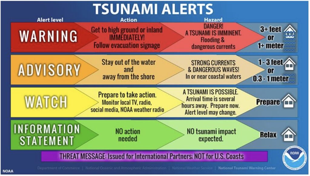
Our last Tsunami Advisory was for the 2022 Tonga Eruption. Our last Tsunami Warning was way back in 2011 for the Tohoku, Japan M9.1 earthquake (Fukushima event). There are 2 different ways of getting a tsunami warning depending if the offshore earthquake or other trigger event was distant or local.
Distant tsunamis give scientists time to analyze more data and confirm a large tsunami was generated before issuing a warning. A tsunami watch may be issued in the interim.
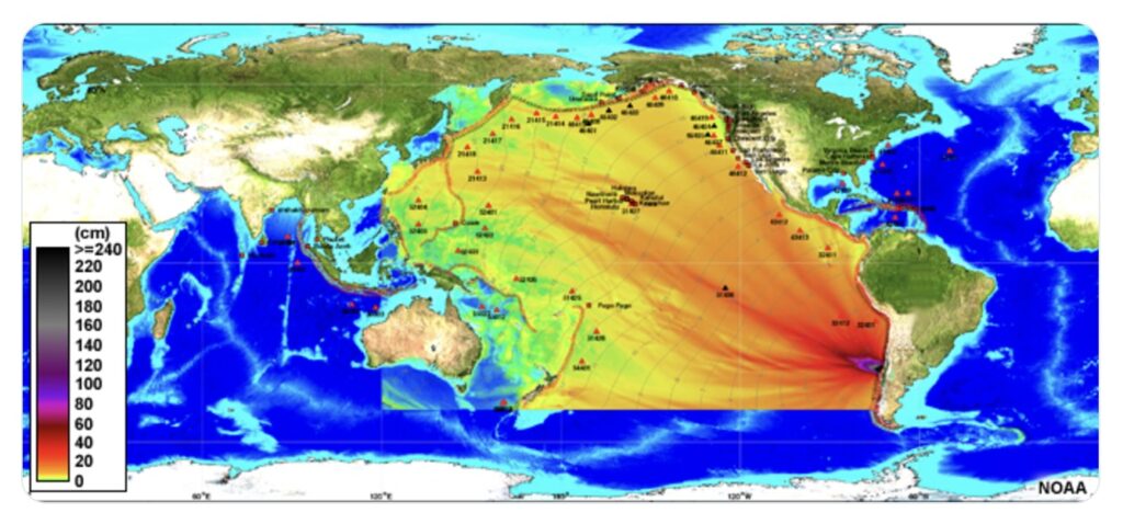
There is much less time with a local tsunami, and the warning must be issued with more uncertainty in order to allow the maximum possible evacuation window. Yesterday’s event was this type. Let’s revisit the timeline:
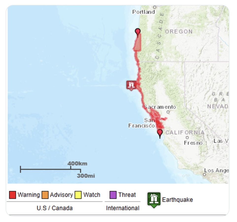
10:44 AM: a preliminary assessment suggests a 7.3 magnitude earthquake occurred 45 miles SW of Eureka (later downgraded to 7.0).
10:49 AM: the National Tsunami Warning Center (NTWC) issued a Tsunami Warning for the CA coast north of Davenport (including the San Francisco Bay).
5 minutes between the earthquake and warning. The NTWC is staffed 24/7, always ready to react this quickly to a new tsunami threat. When it happens this close to the coast, time is critical to enable evacuations as tsunami waves travel very fast (up to 500 mph in the deep ocean).
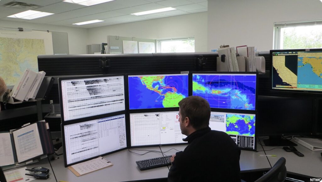
The downside of this speed requirement is that the NTWC does not have the luxury of waiting to actually observe a tsunami wave before the first warning is needed. They can only confirm that with deep ocean buoys and coastal observations.
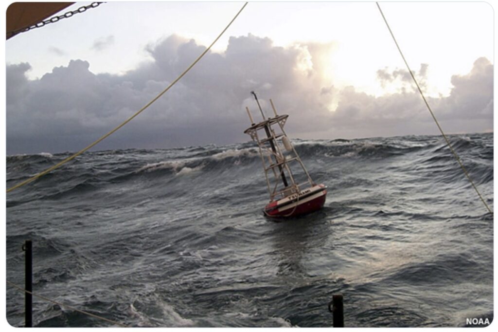
After the first warning was issued, the scientists at the NTWC continually analyze the latest data on the faulting mechanism and strength of the earthquake, as well as measurements, signs, and/or reports of any tsunami waves.
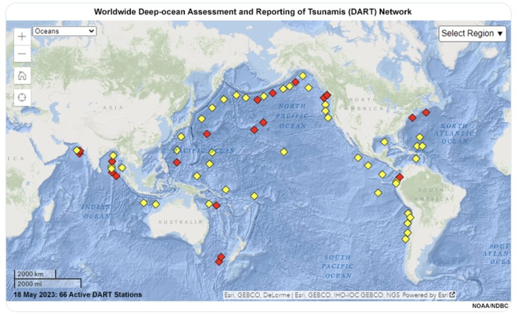
In this case, all incoming data after the earthquake pointed to no damaging tsunami threat. The warning was ultimately cancelled at 11:54 AM. 70 minutes after is was issued.
Let’s talk about the science. What can cause a tsunami?
While approximately 80% of tsunamis are generated by offshore earthquakes, they can also be triggered by underwater landslides, volcanic eruptions, and from meteorological origin.
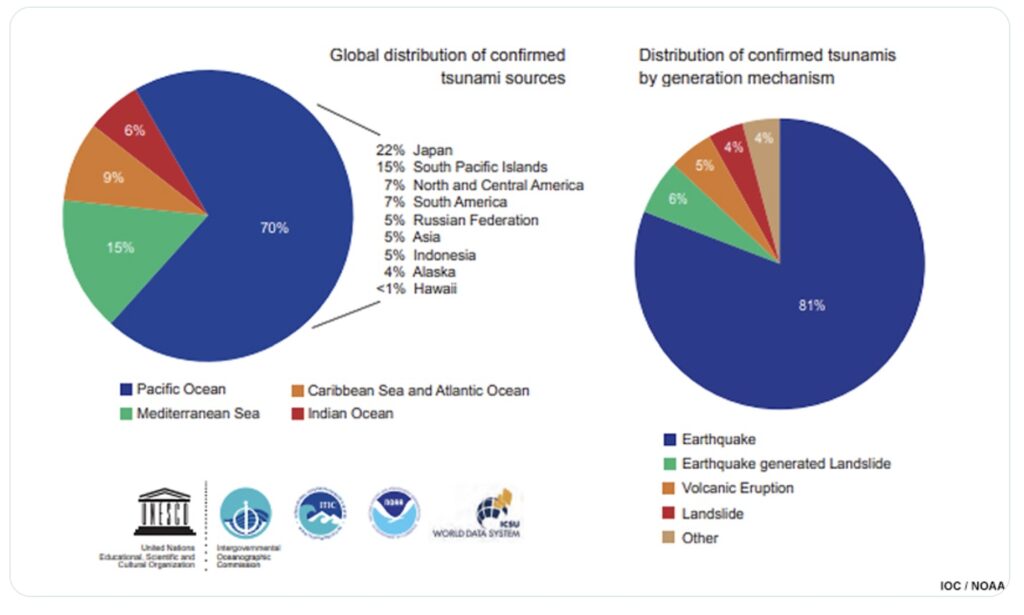
Tsunamis are caused by a large and sudden displacement of the ocean. While all earthquakes shake the ocean, that doesn’t cause a tsunami. We need the water column to rise or fall rapidly.
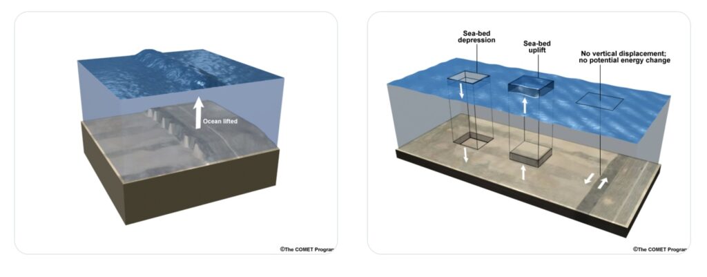
The most common way for this to happen is during an earthquake along a subduction zone when the ocean floor rises or drops. Transform fault (a specific type of slip fault) earthquakes are much less likely to generate a tsunami (but still possible with steep bathymetry or landslides).
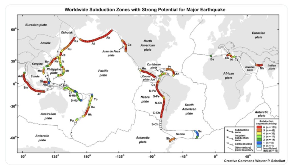
The strength, depth, and duration of the earthquake are also important. Typically a 7.0 is needed for a damaging local tsunami, and an 8.0 (10x stronger) is needed for a damaging distant tsunami.
These are just rough guidelines. Other factors (earthquake depth, duration, orientation, accompanying landslides) also play a role.
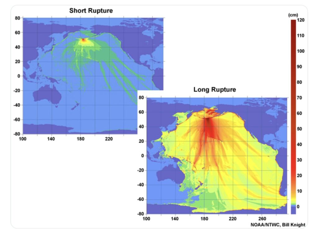
Yesterday’s earthquake was significant, but occurred on a transform fault and only generated a small tsunami.
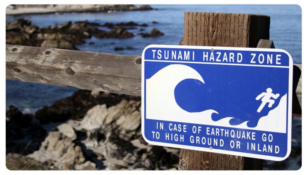
It’s important to know the risks. A tsunami can happen any time and there’s a chance that a near shore tsunami beats the first warning. If you’re on the coast and feel an earthquake, get to higher ground immediately. Don’t wait for a warning.
If a warning goes out and evacuations are ordered, heed the instructions. Do not enter an evacuation zone to try and see the tsunami. This water travels much faster than you can run.
We were fortunate yesterday, but don’t assume the next warning will play out the same way.
If you evacuated, you did the right thing. Tsunamis are rare, but can be extremely deadly. For perspective, roughly 230,000 people lost their lives in the 2004 Indian Ocean Tsunami, the deadliest natural disaster of the 21st century.
We understand the confusion and disruption this warning caused. Hopefully this thread helped clear up the warning process and rationale. The National Weather Service strives to reduce false alarms while protecting life and property.
You can learn more about tsunamis here.
A “slip fault” (video) is a general term for any fault where the rock blocks move past each other, while a “transform fault” is a specific type of slip fault that occurs at a plate boundary where two plates slide horizontally past each other, meaning it is a strike-slip fault located at a plate boundary; essentially, all transform faults are slip faults, but not all slip faults are transform faults.
Key points about the difference:
- General vs. Specific: “Slip fault” is a broad term describing any fault with sliding motion, while “transform fault” refers to a specific type of slip fault that happens only at plate boundaries where plates slide past each other.
- Location: A slip fault can occur anywhere within the Earth’s crust, while a transform fault is always found along a plate boundary.
- Movement: Both slip faults and transform faults involve horizontal movement (strike-slip motion), but the key distinction is that a transform fault connects two areas of plate divergence (like mid-ocean ridges) and ensures that the distance between them remains constant.
Example: The San Andreas Fault in California is a well-known example of a transform fault, as it marks the boundary where the Pacific Plate slides past the North American Plate.

2024 Election


The 2024 Board of Supervisors, from left: Ray Mueller (D3), Noelia Corzo (D2), Warren Slocum (D4, BOS President), David J. Canepa (D5, BOS Vice President) and Dave Pine (D1, outgoing BOS President).


