|
Getting your Trinity Audio player ready...
|
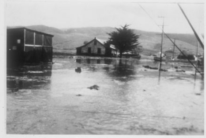
 As winter storms sweep through the Coastside and cause large waves and flooding, we can cast our minds back to another event that resulted in flooding and big waves, but from a very different cause. Around 10:30 a.m. on April 1st, 1946, Coastside residents were surprised by a tsunami. Known as the April Fool’s Day Tidal Wave, this was one of the most destructive tsunamis the Coastside has witnessed.
In 1946, a 7.8 magnitude earthquake occurred off the Aleutian Islands in Alaska at a convergent fault, thus creating the perfect storm for a massive tsunami. After hitting hard in Alaska, the wave traveled and devastated parts of Hawai’i and then hit the West Coast of the United States. Fun fact—after this earthquake, the Pacific Tsunami Warning Center was created to generate some tsunami-preparedness across the Pacific.
On the Coastside, the tsunami hit hardest in Princeton. There were 15-foot-high waves buffeting the whole area and a rise of 2.6 meters/8.5 feet in tides from normal levels. The first wave was a trough and the sea dropped 7 feet. The second wave brought flooding.
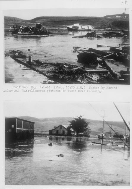
The Half Moon Bay Review wrote on April 4, 1946, on its front page: “Several small tidal waves followed in successive order a few minutes apart Monday at Princeton. It flooded homes, shoved boats nearly 1,000 feet inland, uprooted fences, washed automobiles from their parking spots for distances of sixty feet and did damage along the Coastside that may total $20,000.”
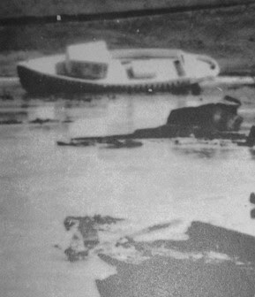
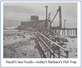
Some residents weren’t as concerned as the Review’s report seemed to warrant. In an interview in 2006, local commercial fisherman Nat Johnson recounted how he noticed that a boat at the pier “kind of looked high” but he “paid no attention to it.” He was laying the foundation for a crab kettle at Hazel’s Sea Foods (located at present-day Barbara’s Fish Trap) and went back to his work. Then, he recalled, “there was no wave, just the water rose slow… it came across the highway and down below.” He even laughingly recalled John Patroni, the owner of the Patroni House, yelling, “Run for the Mountains, it’s a tidal wave,” before the wave stopped advancing. Mr. Johnson remembered it as one surge and then it was gone.
The Review reported, “through it all there was no injury to persons, although several chickens were washed out to sea on the ebb of several of the waves.”
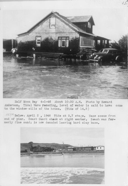
There was plenty of damaged property and flooded roads. A report on United States tsunamis by several U.S. federal agencies described that a house was flooded to the windowsills.
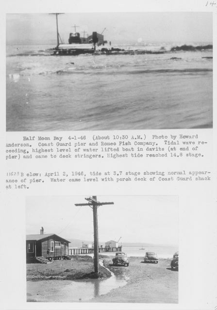
The Coast Guard barracks in Half Moon Bay—luckily unoccupied—flooded, and the building was loosened from its foundations. Water “was about 1 m deep on the road” and “at nearby Granada a 10 m boat was washed onto the highway.”
The next day, the San Mateo Times reported on the aftermath. It wrote, “Fearful that a high tide at midnight last night might result in more damage, a number of persons gathered at the Nerli restaurant to keep a midnight watch on the tide. Shortly after midnight, the restaurant closed and all departed.”
Residents were wary of the higher tides but were overall grateful that worse had not happened. The Times continued: “Mrs. James W. Healy was busily engaged today with a hoe scraping mud and sea-weed from her living room.” She then reportedly said, “After the midnight high tide, and with nothing more happening, we went to bed. This is a mess, but when I think of what happened in the Hawaiian Islands I don’t think we can complain too much.”
In 2014, researchers with the California Geological Survey and Humboldt State University came to the Coastside to study sediment deposits in the Pillar Point marsh from the 1946 tsunami. They sought to study, and develop more methods to study, how historic tsunamis affected coastal areas and thus help prepare for future disasters. Tsunami preparedness saves lives, and no resident present for the 1946 tsunami was likely to forget it.
Searching for photos of the 1946 tsunami leads to the unexpected..
Here are the photos, all courtesy: Robert L. Wiegel Coastal Slide Collection, Water Resources Center Archives–University of California, Berkeley
1. Anderson, Howard (UCB Waves Project). About 10:30 a.m. Coast Guard pier and Romeo Fish Company. Tidal wave receding, highest level of water tried to lift boat in davits (at end of pier) and came to deck stringers. Highest tide reached 14.8 stage. (Robert L. Wiegel Coastal Slides Collection.)
2. Anderson, Howard (UCB Waves Project). April 2, 1946, tide at 3.7 stage, showing normal appearance of pier. Water came level with porch deck of Coast Guard shack at left. (Robert I. Wiegel Coastal Slides Collection.)
3, 4. Anderson, Howard (UCB Waves Project). Half Moon Bay 4-1-46. (About 10:30 a.m.) Miscellaneous pictures of tidal wave receding.(Robert L. Wiegel Coastal Slides Collection.)
5. Anderson, Howard (UCB Waves Project) Half Moon Bay. About 10:30 a.m. Tidal wave receding, level of water is said to have come to the window sills of the house. Tide of 14.8 (Robert L. Wiegel Coastal Slides Collection.)
6. April 2, 1946. Tide at 3.7 stage. Same scene from end of pier. Coast Guard shack at right center. Beach was formerly fine sand; is now denuded, leaving hard clay base. (Robert L. Wiegel Coastal Slides Collection.)
