|
Getting your Trinity Audio player ready...
|
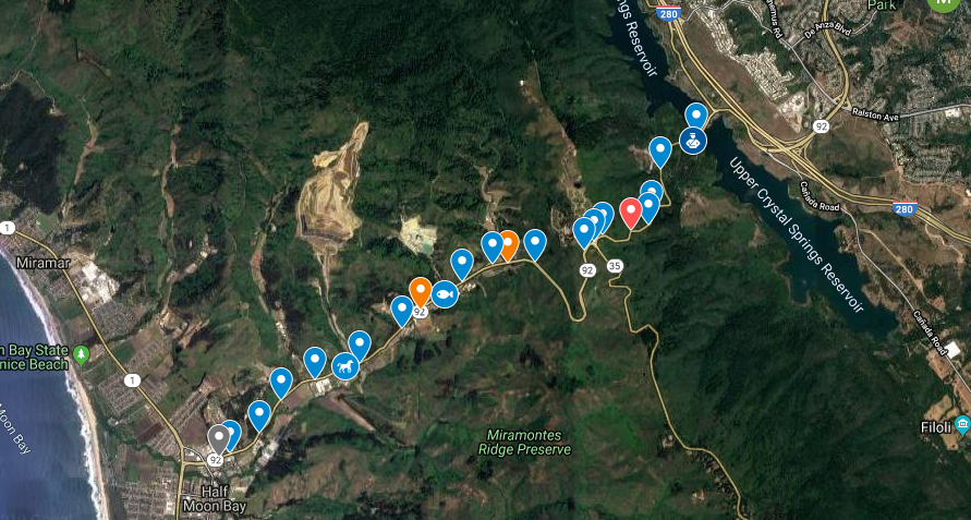
ARTICLE / MAP. In case you missed this on Nextdoor.
Hi, The subject of “92” comes up a lot on Nextdoor (from Coastsider John Hauer). I realize we talk about it at home a good deal, as well. Usually, the conversation starts:
“Where’d you get stuck?” Or,
“How close to HMB did you get before you turned around?” Often followed by,
“Only an hour and a half to drive through La Honda? That’s pretty good.”
Here is link to below map. The Map is synced to John’s list. Map by Coastsider, Jack Walicki, from Nextdoor.
Anyway, here are what we call the various spots on the drive:
From the SM side over:
The Reservoir – anywhere near the flat part near skyline and 92 and 280.
The Weigh Station – the pullout for truck weighing.
The Ticket Turnout – The last dirt pull off before heading up.
The Passing Lane – the place where some slow drivers will even pull over and let traffic go by.
The First Curves – right after the passing lane.
The Forest – that clump of trees with the guard rail where there can be a crash.
The Death Curve Approach – just after the forest and just before death curve.
Death Curve – we hang our heads quietly to think of those who did not make it through this curve – no joke, this is the most serious place on the road.
Just Before the Cemetery – Pretty much two curves (or so) that approach the top.
The Cemetery – the whole pull-out part where we hope that slow drive takes a rest.
Skyline – the top intersection.
Divided Downhill – the smoother divided stretch going down.
Including “The View” – where the sunset looks great while you are stopped in traffic. Last chance to check email if you are going to lose service. Most people can’t get a signal between the fake rock walls.
The Crystal Spring – the bottom of the divided part. (the now-defunct Lombardi water spring closed due to lethal poisoning – or some such tale).
The Tree Farm – where the forever-for-sale 40+ acre lot resides
The Nursery or the Quarry – the single-striped divided part where people try to pass other cars while going west.
The Fishing Pond – where you used to be able to go trout fishing
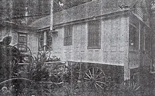
The S-curve or House of Doors – the second most likely accident place
The Arty Place – who needs a rusted steel animal for the yard?
The cause of global warming, and traffic, and excess tourism –
“The Pumpkin Farms” – a place where no pumpkins are actually grown. Sometimes called “the winery.”
The Teak Place – The furniture looks good, but I am afraid to stop.
The Fruit Stand – I wish they had cases of artichokes
The Firewood Place/ Spanish town – I hear there is a restaurant in there. Again, afraid to stop for fear of getting stuck, or worse.
The Trailer Park – I wish I had bought one of these when they were $30k.
The Very Ugly Entrance to HMB – including the trailers, auto repair places, fish place, gas station, massage parlor, 7-11 and the other ugly fish place. Um, maybe we should try to fix the entrance to our town. 92 and Main are a real eyesore. IMHO, the new neon massage parlor signs are not helping at all. Who approved those?
When you are going the other way, most of the names are the same except one big exception – “The raceway.” That is the 2-lane divided section where even normal people think that that need to drive 70 MHP for 1/2 a mile.
Did I miss any term that you use?
~ From John Hauer, via Nextdoor
Bonus Link! from REEL SF
“San Francisco movie locations from classic films”
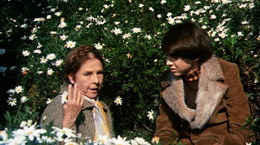
HAROLD AND MAUDE – SUNFLOWERS AND DAISIES
March 27, 2016
A photo essay of the time Harold and Maude spent on the coastside.
