Sorry, no records were found. Please adjust your search criteria and try again.
Sorry, unable to load the Maps API.
El Granada, California 94019
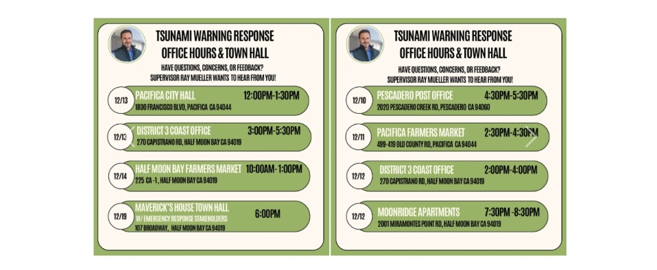
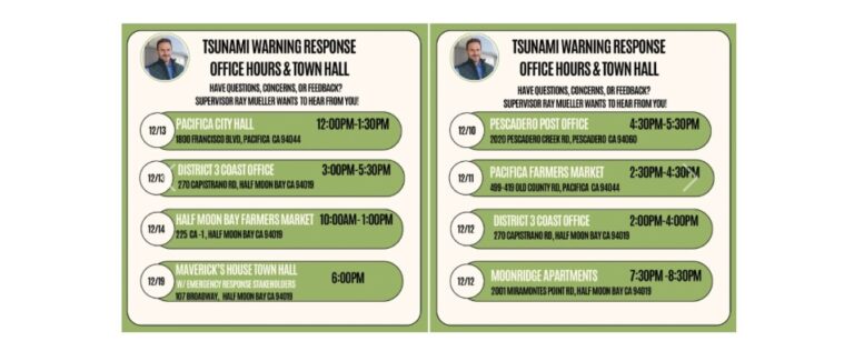
Attention Coastside residents from Pescadero to Pacifica, I will be having seven Office Hours events over the next two weeks culminating with an eighth Town Hall, with Emergency Management stakeholders, on December 19th, 2024 to gain feedback and discuss the Tsunami Warning Event Response. Please join us and share your experiences.
Note that the 12/19/2024 meeting will be held at the Mavericks House in Princeton Harbor ~ Emergency Response Stakeholders will be present

_________________________________________________________
Subduction or Slip Fault? National Weather Service Explains History, Science and Timeline of the Tsunami Warning Process and How Decisions are Made after Coastal Quakes
ARTICLE. From the National Weather Service Bay Area on December 6th, 2024.
Let’s talk about the recent tsunami warning on Thursday, December 5th, 2024. We don’t get these alerts very often and there are lot of questions, frustration, and even some anger about how it all unfolded. We’ll go over the history, science and warning process. How common are tsunami warnings in California? There are several types of tsunami alerts, and warnings are the most critical.
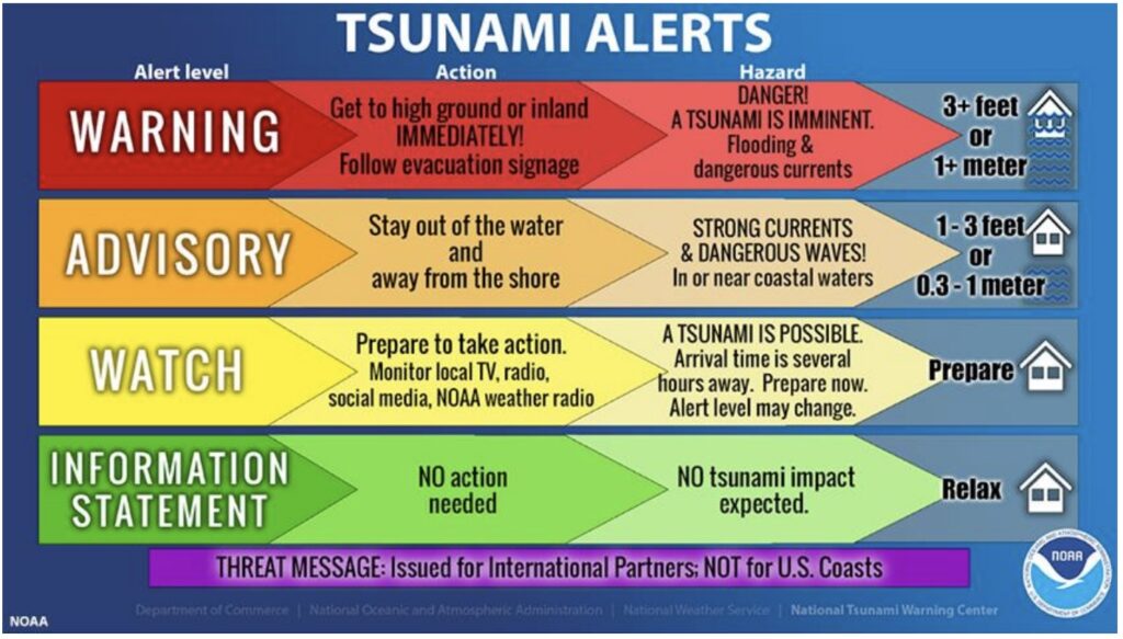
Our last Tsunami Advisory was for the 2022 Tonga Eruption. Our last Tsunami Warning was way back in 2011 for the Tohoku, Japan M9.1 earthquake (Fukushima event). There are 2 different ways of getting a tsunami warning depending if the offshore earthquake or other trigger event was distant or local.
Distant tsunamis give scientists time to analyze more data and confirm a large tsunami was generated before issuing a warning. A tsunami watch may be issued in the interim.
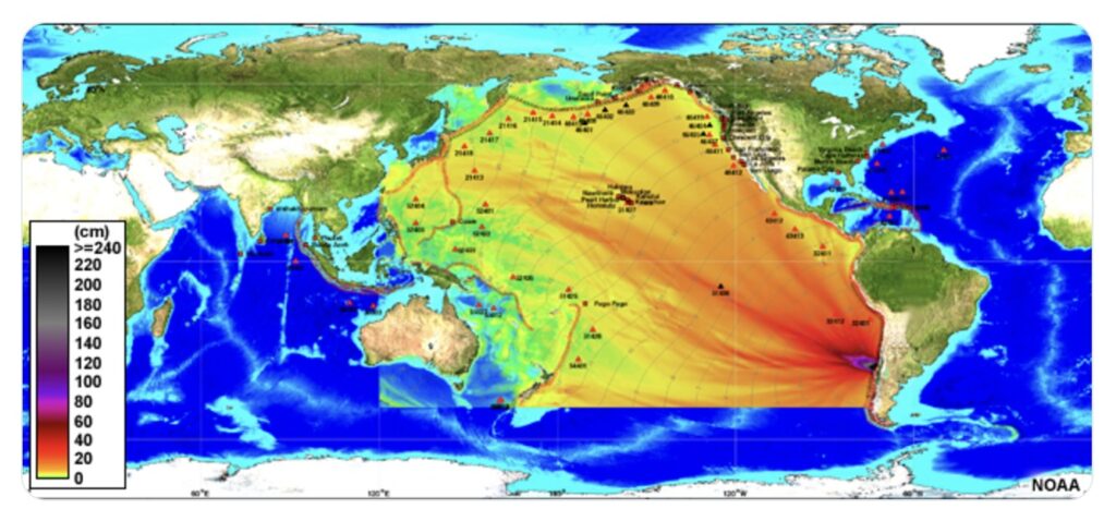
There is much less time with a local tsunami, and the warning must be issued with more uncertainty in order to allow the maximum possible evacuation window. Yesterday’s event was this type. Let’s revisit the timeline:
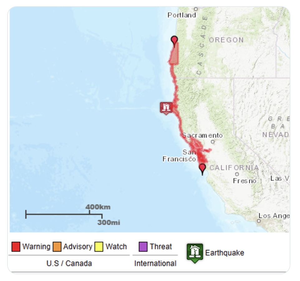
10:44 AM: a preliminary assessment suggests a 7.3 magnitude earthquake occurred 45 miles SW of Eureka (later downgraded to 7.0).
10:49 AM: the National Tsunami Warning Center (NTWC) issued a Tsunami Warning for the CA coast north of Davenport (including the San Francisco Bay).
5 minutes between the earthquake and warning. The NTWC is staffed 24/7, always ready to react this quickly to a new tsunami threat. When it happens this close to the coast, time is critical to enable evacuations as tsunami waves travel very fast (up to 500 mph in the deep ocean).
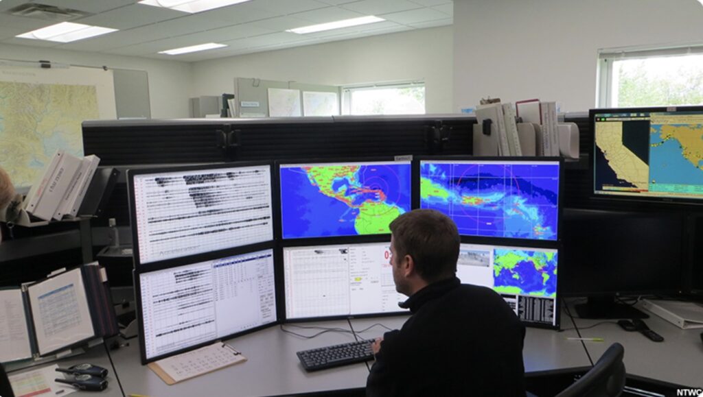
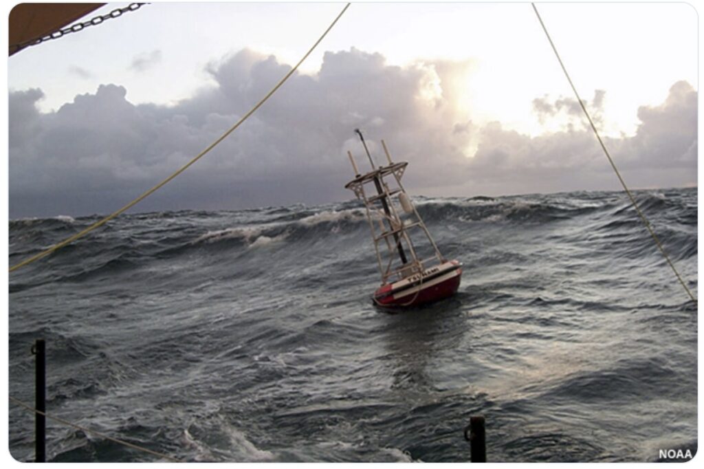
The downside of this speed requirement is that the NTWC does not have the luxury of waiting to actually observe a tsunami wave before the first warning is needed. They can only confirm that with deep ocean buoys and coastal observations.
After the first warning was issued, the scientists at the NTWC continually analyze the latest data on the faulting mechanism and strength of the earthquake, as well as measurements, signs, and/or reports of any tsunami waves.
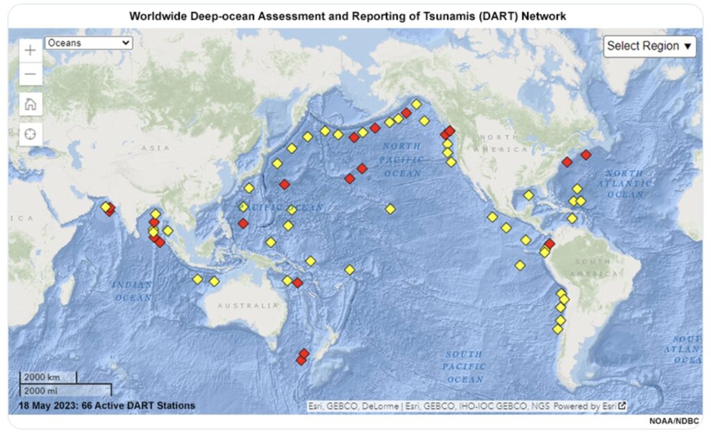
In this case, all incoming data after the earthquake pointed to no damaging tsunami threat. The warning was ultimately cancelled at 11:54 AM. 70 minutes after is was issued.
Let’s talk about the science. What can cause a tsunami?
While approximately 80% of tsunamis are generated by offshore earthquakes, they can also be triggered by underwater landslides, volcanic eruptions, and from meteorological origin.
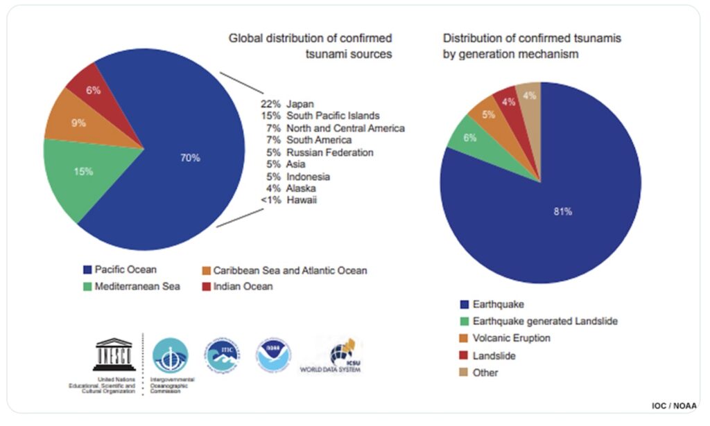
Ok, but why do some strong earthquakes generate tsunamis while others don’t?
Tsunamis are caused by a large and sudden displacement of the ocean. While all earthquakes shake the ocean, that doesn’t cause a tsunami. We need the water column to rise or fall rapidly.
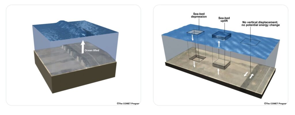
The most common way for this to happen is during an earthquake along a subduction zone when the ocean floor rises or drops. Transform fault (a specific type of slip fault) earthquakes are much less likely to generate a tsunami (but still possible with steep bathymetry or landslides).
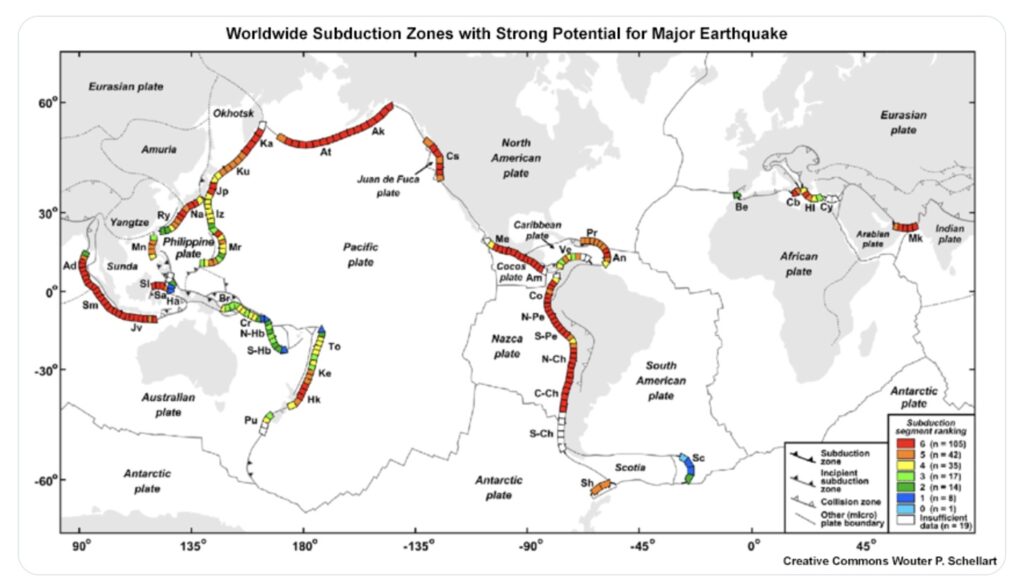
The strength, depth, and duration of the earthquake are also important. Typically a 7.0 is needed for a damaging local tsunami, and an 8.0 (10x stronger) is needed for a damaging distant tsunami.
These are just rough guidelines. Other factors (earthquake depth, duration, orientation, accompanying landslides) also play a role.
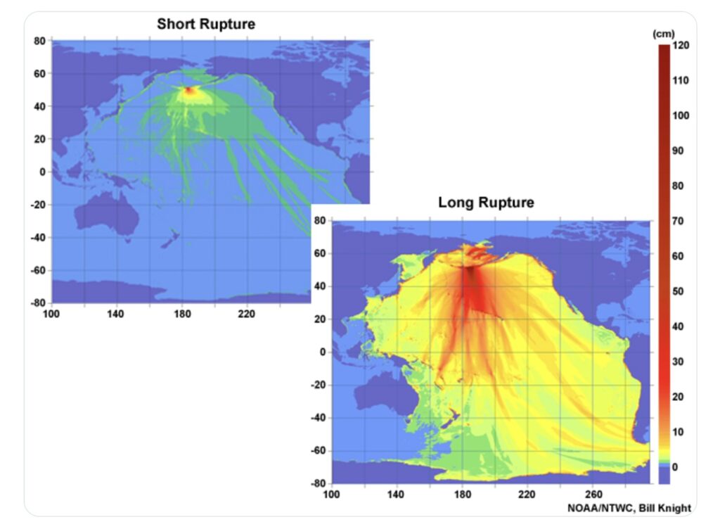
Yesterday’s earthquake was significant, but occurred on a transform fault and only generated a small tsunami.
It’s important to know the risks. A tsunami can happen any time and there’s a chance that a near shore tsunami beats the first warning. If you’re on the coast and feel an earthquake, get to higher ground immediately. Don’t wait for a warning.
If a warning goes out and evacuations are ordered, heed the instructions. Do not enter an evacuation zone to try and see the tsunami. This water travels much faster than you can run.
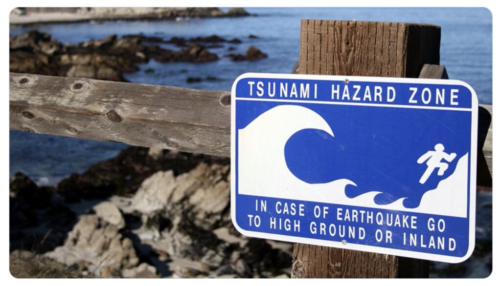
We were fortunate yesterday, but don’t assume the next warning will play out the same way.
If you evacuated, you did the right thing. Tsunamis are rare, but can be extremely deadly. For perspective, roughly 230,000 people lost their lives in the 2004 Indian Ocean Tsunami, the deadliest natural disaster of the 21st century.
We understand the confusion and disruption this warning caused. Hopefully this thread helped clear up the warning process and rationale. The National Weather Service strives to reduce false alarms while protecting life and property.
You can learn more about tsunamis here.
A “slip fault” (video) is a general term for any fault where the rock blocks move past each other, while a “transform fault” is a specific type of slip fault that occurs at a plate boundary where two plates slide horizontally past each other, meaning it is a strike-slip fault located at a plate boundary; essentially, all transform faults are slip faults, but not all slip faults are transform faults.
Key points about the difference:
- General vs. Specific: “Slip fault” is a broad term describing any fault with sliding motion, while “transform fault” refers to a specific type of slip fault that happens only at plate boundaries where plates slide past each other.
- Location: A slip fault can occur anywhere within the Earth’s crust, while a transform fault is always found along a plate boundary.
- Movement: Both slip faults and transform faults involve horizontal movement (strike-slip motion), but the key distinction is that a transform fault connects two areas of plate divergence (like mid-ocean ridges) and ensures that the distance between them remains constant.
Example: The San Andreas Fault in California is a well-known example of a transform fault, as it marks the boundary where the Pacific Plate slides past the North American Plate.


