|
Getting your Trinity Audio player ready...
|
 OWN VOICE. ~ InPerspective by Gregg Dieguez —
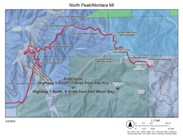
A couple of weeks ago, the MCC was alerted to an emergency on Montara Mountain by the Department of Emergency Services (DEM). In follow-up, the mountain is going to be closed for emergency repairs. Read more to understand the situation.
As some of you will know from having read the MCC’s Communications Work Group report, much of our area’s communications comes through the cell towers atop Montara Mountain. And you are all likely familiar with the power failures PG&E is prone to. What you may not know is that:
a) there are backup generators atop that mountain, in case the power goes out and
b) our EMERGENCY radio relay, which the CERT teams rely on, also goes through equipment atop that mountain.
The implication is, if those emergency generators do not work during a power outage, the Midcoast won’t even have EMERGENCY communications. And the roads to that mountain had become impassable for utility vehicles carrying either diesel fuel or propane. SFPUC has closed the East trail which had been used for a period to compensate for loss of the normal access road.
As a result, the MCC had to quickly consider whether the OES/DEM actions justified an emergency meeting. We decided that we would not oppose those efforts and planning advanced under project manager Dave Barnett of DEM. Mr. Barnett also presented the situation at the MCC meeting on May 10th, and links to his talk and supporting materials are below in this article.
Since that early scramble, the road became even more hazardous, to the degree that they could not even begin the work they had planned until it dried. An accident with a utility vehicle a few years back punctuated the risks they faced and reinforced their caution. My understanding is that they were able to deliver a little fuel via ATV’s, but the supply is not sufficient for a prolonged PG&E outage.
We confirmed with DEM today the following:
- Work on the mountain access road will begin May 30th.
- The road will be closed to ALL access until the road repairs are complete. Per DEM: “Residents need to understand that being in the work area when crews and heavy equipment is operating would be very dangerous. We are especially concerned with mountain bikers that may disregard closures. We’ll have flagging, signs and staff on site to assist in maintaining the closures and safety.“
- The expected completion date is June 9th. I will update with another article and announcement through the MCC if this changes.
Finally, once the trail is open, I encourage our more fit and adventurous residents to visit the top and assess the affect on the vegetation and landscape. As you will see in the attachments linked below, considerable effort was made to ensure both safety and environmental impacts. The planning process described to the MCC seemed thorough and considerate, but remember: “Trust, but Verify”.
Here are links to supporting documents provided by DEM:
A. DEM Report North Peak Montara Mtn Road
 More From Gregg Dieguez ~ InPerspective
Mr. Dieguez is a native San Franciscan, longtime San Mateo County resident, and semi-retired entrepreneur who causes occasional controversy on the Coastside. He is Chair of the MCC, but his opinions here are his own, and not those of the Council. In 2003 he co-founded MIT’s Clean Tech Program here in NorCal, which became MIT’s largest alumni speaker program. He lives in Montara. He loves a productive dialog in search of shared understanding.


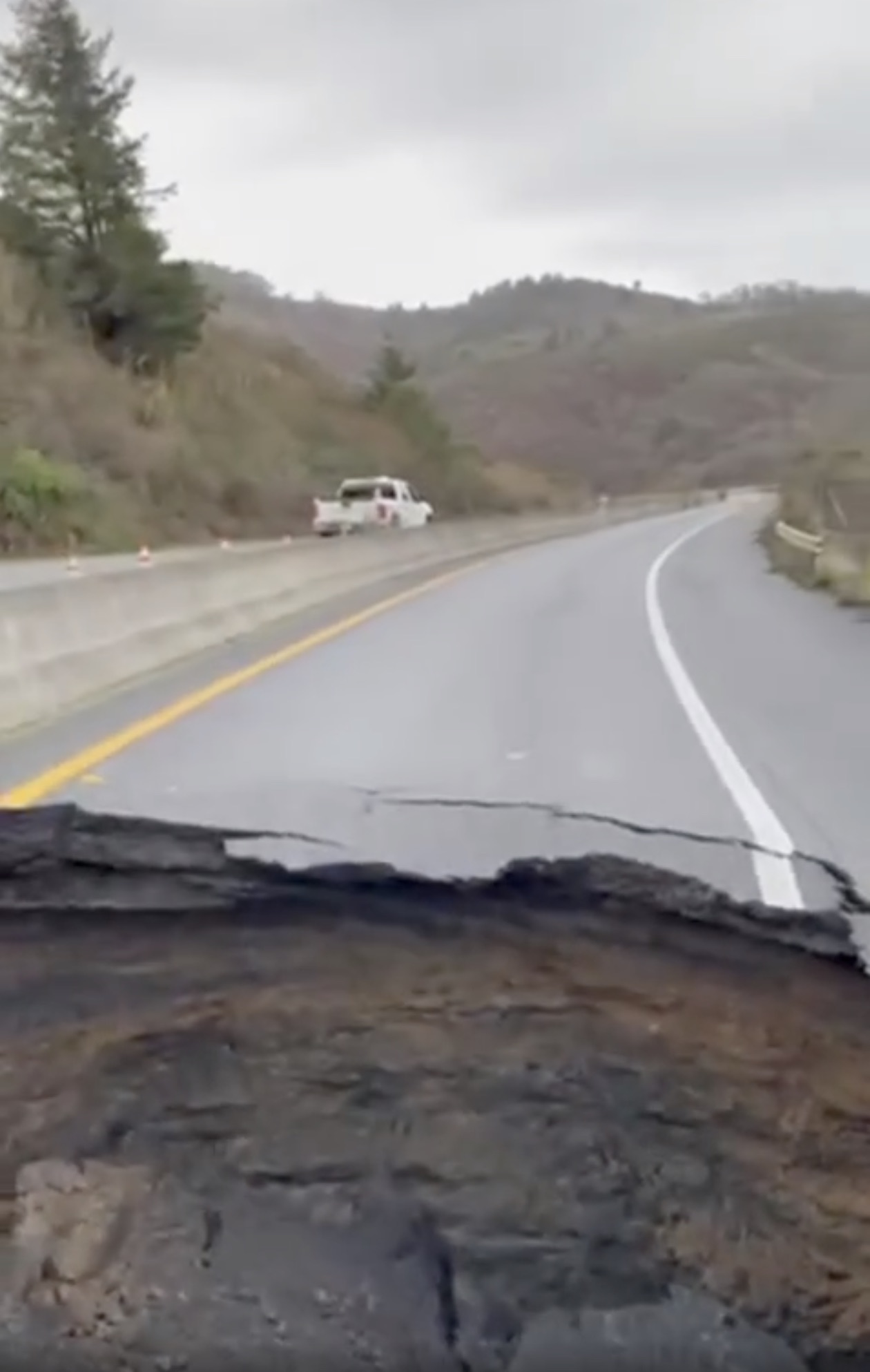

I have been walking this road since McNee Ranch was opened to the public in 1985. In that time there have been numerous road maintenance efforts, sometimes effective briefly but usually demonstrating a lack of institutional knowledge, a failure to learn from previous efforts, and a lack of sensitivity to the park. In this description, there are good activities and bad. The most important thing to remember is that the troublesome erosion is caused by runoff on and from the road, itself. (Runoff starting with the road caused debris flows, severe gully erosion, and was, in fact, the primary cause of the Route 1 outages when highway culverts plugged up and the fills they crossed at Green Valley and Martini Creek broke in the winter of 1982-83.) The current condition of the road is no exceptional deal in light of the past, especially past el Nino years when, unlike this past winter, storms rained down every day for more than 20 days with no rainless days between storms. Another thing to remember, the wider the road, the greater the erosion-causing runoff.
The tree removal is no big deal. All pines, cypresses, and eucs in the area are weeds and causing damage to the natural, native vegetation and loss of biodiversity, as little grows under them. The more trees cut away, the better. In the same breath, it must be stated that cutting of large native bushes, some up to small tree size (Ceanothus, coffee berry, manzanita, golden chinquapin) has gone far beyond the edge of the road on several occasions, causing ecological damage as such ecosystem services as “raking” the fog for moisture during rainless months and providing protection for understory plants is reduced.
Grading away the berm on the downhill side of the road will allow more runoff to saturate the topsoil and reach the interface between the topsoil and the granite rock beneath. Bad idea. Erosion of the hillside below and, in extreme cases, debris flows occur when there is enough water on the interface to reduce the friction that holds the topsoil and all that grows on it in place. Using the material graded from the berm and from the road surface to fill eroded gullies on the road is a waste of effort. That approach has been used time and again and the graded material never lasts in the gullies beyond two or three good rainstorms. There are obvious better ways to catch the runoff from the road and disperse it, and, to this end, existing culvert rehabilitation and installation of new culverts will help. Importantly, the downhill ends of the culverts must be T’ed off for dispersal of water over a wider surface. The entire scheme should be directed to catching runoff from the road surface before it builds up energy and dispersing it in locations and over a wide enough area that it will not cause hillside erosion.
I was not at all encouraged when the county’s emergency services guy seemed to brush off Kimberly Williams’s tentative concerns.