|
Getting your Trinity Audio player ready...
|
OWN VOICE. ~ InPerspective by Burnett Silveria and Gregg Dieguez —
This continues a series of articles about unmanaged stormwater affecting the Midcoast. This week’s subject is El Granada, which has longstanding drainage issues, many stemming from Quarry Park.
You may recall SMC Parks’ work the past few years in removing eucalyptus trees to mitigate wildfire hazards, and the #1 priority for wildfire fuel reduction identified in the 2022 RCD Wildfire Scoping Study: Deer Creek. As several residents are already aware, before the eucalyptus was planted, Deer Creek flowed year-round through El Granada neighborhoods. Eucalyptus are known to drain water wells and have even been used to DRAIN SWAMPS, because they absorb and evaporate so much groundwater. Removing the invasive eucalyptus to combat wildfire risk and restore chaparral is naturally restoring Deer Creek and other small waterways, exacerbating the stormwater problem downstream of areas of fuel reduction. Eucalyptus wildfire fuel mitigation efforts in unincorporated SMC have made significant advances since the 2021 Planning Department exemption for trees within 100 feet of structures, and the RCD Scoping Project will hopefully result in significant additional eucalyptus removal from Quarry Park. Since continuation of the fuel reduction efforts is a critical ongoing public safety measure, further gains in waterway restoration must be expected, prompting immediate planning and appropriate stormwater management construction for drainage
By removing wildfire-prone eucalyptus to combat wildfire risk, we may have inadvertently exacerbated an already worsening stormwater problem downstream of Quarry Park. Hence the title of this article, but there’s much more, so please read on.
Footnotes: to use, click the bracketed number and then click your browser Back button to return to the text where you were reading.
Images: Click to enlarge for improved readability in a new window.
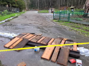
How do you identify examples of stormwater[1] flooding in El Granada? One – live near Quarry Park; two – drive around El Granada after a big storm and identify areas of flooding, then follow-up in a couple of days and observe those same areas. Why identify examples of stormwater flooding in El Granada? – as part of a larger effort to justify County action. The MCC has a subcommittee working on a report to define and address stormwater problems on the Midcoast in support of Supervisor Ray Mueller’s Coastal Resilient Infrastructure Strategic Plan (CRISP). To do so, the MCC has enlisted resident participation to document examples of stormwater problems from its various neighborhoods – including flooding in El Granada. El Granada, like most of the Midcoast, suffers from a decades-old lack of an adequate and integrated stormwater system.
The atmospheric river storms of December 31, 2022 and January, 2023 had already passed, so during and after the heavy storm in early March, 2023, we made observations throughout El Granada from 3/10/2023 thru 3/12/2023 to determine stormwater flooding conditions. Four main areas were identified as examples of uncontrolled and unsafe stormwater runoff that resulted in flooding long distances down residential streets – making those streets dangerous to traverse and many sidewalks & handicap access ramps dangerous and useless.
The four examples below all display a lack of an adequate and integrated stormwater system in El Granada endangering both El Granada neighborhoods and the safety of their residents. What was once adequate drainage for stormwater runoff trickling down unpaved residential streets in El Granada has risen to flooding, as San Mateo County has sanctioned more development without adequate infrastructure and/or impact fees together with the increase in severity of winter storms. Recently, San Mateo County has attempted to address the issue – but only selectively and minimally.
The four major examples of observed uncontrolled and unsafe stormwater flooding neighborhoods in El Granada, in degree of severity (worst to least), are:
1. Santa Maria Ave. & Columbus St – stormwater runoff from Quarry Park
2. Ave. Portola – stormwater runoff from the Highlands
3. Ferdinand Ave. – stormwater runoff down Ave. Del Oro & San Carlos Ave.
4. Sonora Ave. – stormwater runoff down Ave. Granada & Solano Ave.
1. Santa Maria Ave & Columbus St – the big problem
This entire article could be dedicated to the repeated and ongoing flooding of neighborhood residential streets, intersections, sidewalks, and properties from Quarry Park runoff alone. Come by after a winter storm and see for yourselves. But we’ll try to keep it to the high(low) points.
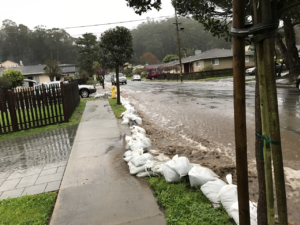
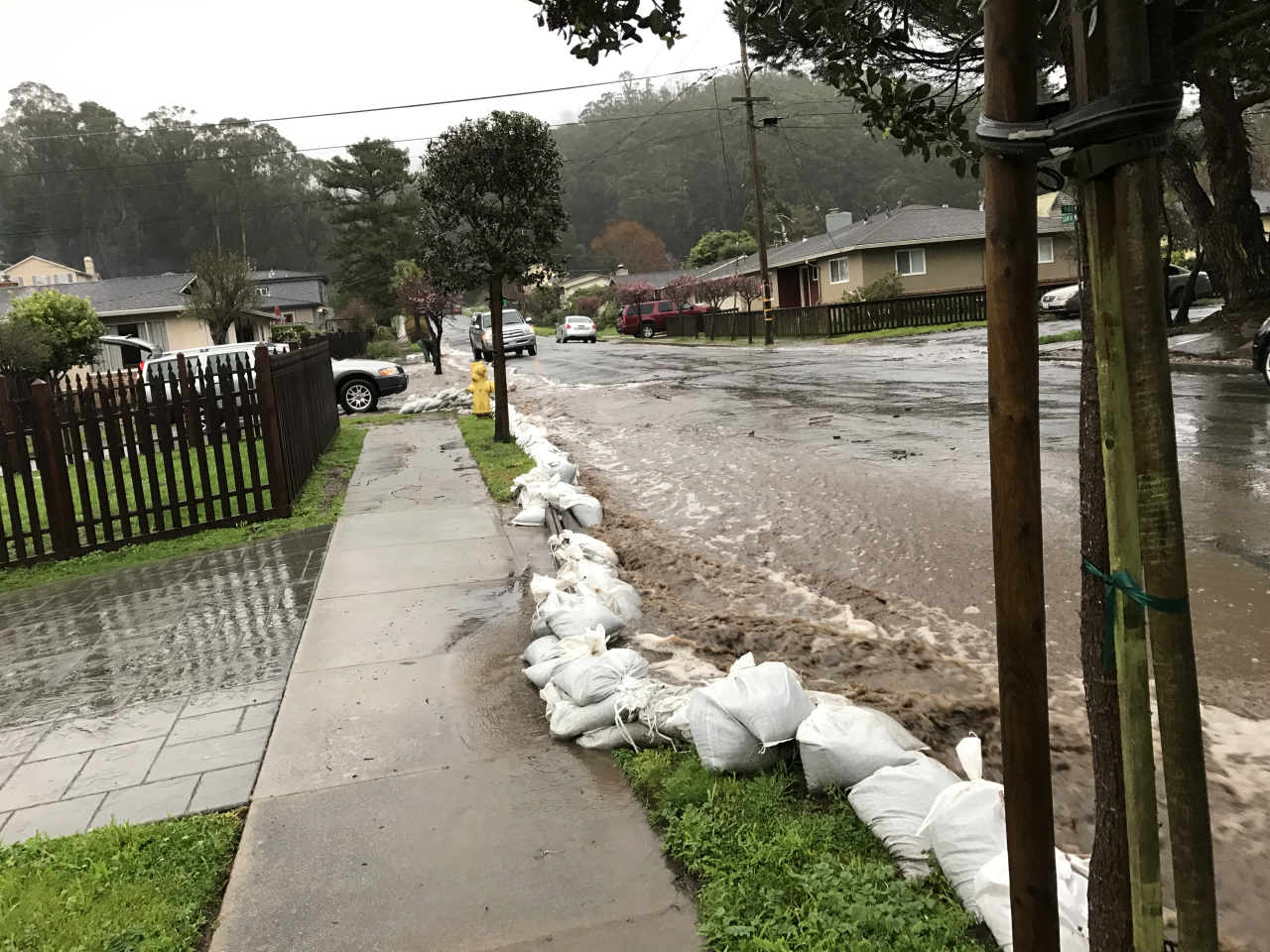
Prior to about 2017, Park runoff stayed in street gutters causing a parking inconvenience and minor concerns at driveways and dipping street intersections. In winter 2017, however, things really took off and runoff began flowing over the gutters down sidewalks and side streets into people’s front yards, and in some cases flooding garages. This flooding continued in winter 2020-2021 and, of course, recently in winter 2022 – 2023. Because of this flooding from Quarry Park, residents are required to sandbag each winter to protect their homes and property from a deluge of impending storm runoff.
The 2018 report by the professionally licensed consultants to the Quarry Park Master Plan (Appendix B to that Plan) summed up the problem pretty well – emphasizing the problem as an “Area of Concern” requiring resolution and noting its potential to damage downstream residential and county properties. The report went on to state that the Santa Maria Ave. & Columbus St. location at the Park’s entrance receives the majority of the Park’s runoff and specifically declared:
There is no obvious effort to manage this runoff in any form of designed drainage structure ever. During field investigations, stream flow was observed traveling across and down the paved road, choosing its own flowpath. Anecdotal accounts from residents report flow exiting the Property has resulted in flooding a large portion of the neighborhood during peak storm events.
The subsequently approved Master Plan, however, provided no solution to the problem although it was repeatedly requested by the neighbors to do so – worry about neighbors’ safety somewhere else. Where else? Still waiting to hear.
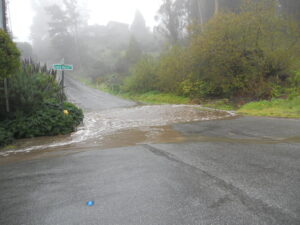
Two runoff flows originate in and exit the park at the intersection of Santa Maria Ave. & Columbus St. near the park’s entrance. The larger and more impactful flow (<< shown in photo at left) comes primarily from the dam’s spillway overflow and floods down Santa Maria, whereas the lesser flow of drainage from SMC Parks’ erosion control efforts mainly floods down Santa Maria with a much lesser impact to Columbus.[2] The combined flows run down Santa Maria flooding over cross streets beginning with Columbus then Francisco then Palma into a pseudo storm drain at the end of Santa Maria at its intersection with The Alameda. The runoff then floods under the east side of The Alameda to an open-air ditch in its median to a new catch basin at Ave. Cabrillo. At the Ave. Cabrillo catch basin, the water enters an underground storm drain system flowing down Ave. Cabrillo to a storm drain as part of the underground storm system at Ave Alhambra.[3]
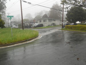
2. Ave. Portola
Following stormwater runoff that flooded down Ave. Portola to its source showed it originated at the intersection of Ave. Portola & Columbus St. It flowed from a large pipe and culvert at Columbus that bellowed stormwater from the Highlands above. The stormwater then flowed down Ave. Portola in deep open-air ditches occasionally passing through pipes under residential driveways and flooding over Francisco and Palma cross-streets to The Alameda where it divided into two directions.
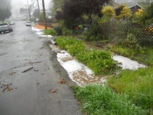
One direction flooded down gutters and sidewalks in The Alameda towards Isabella Ave. to a pipe under the eastern side of The Alameda into a culvert in its median. The second flood path went down Ave. Portola and over Coronado St. to a storm grate and drain that are part of an underground storm system at Ave. Alhambra. Evidence of water pooling at that intersection was also apparent, indicating that drainage capacity is inadequate.
3. Ferdinand Ave.
Tracing the stormwater runoff flooding down Ferdinand back to its source showed it originated from runoff down both Ave. Del Oro & San Carlos Ave. starting at Columbus St. then converged at The Alameda where the two streets converged. The runoff from Columbus down Ave. Del Oro flowed in open-air ditches and through pipes under residential driveways and two cross roads. The flooding crossed over upper Ferdinand Ave. but under Francisco St. and Palma St. to The Alameda convergence. The runoff down San Carlos Ave. just flooded down the edges of the street (no gutters) crossing over Francisco to The Alameda convergence.
The runoff from the convergence then flooded down The Alameda next crossing over the eastern side of The Alameda into a diagonal open-air ditch in its median and continued over the western side of The Alameda to lower Ferdinand crossing over Coronado St. to a storm drain as part of an underground storm system at Ave. Alhambra.[4]
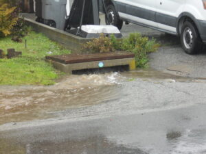
4. Sonora Ave.
Observation of stormwater runoff on Sonora Ave showed flooding runoff from two opposite directions. The single underground storm system storm drain located at the end of Sonora near where it curves towards Coral Reef Ave. was receiving flooding runoff from both its right as well as left sides. Runoff was flooding not only down Sonora from Ave. Granada to the storm drain but also beyond the drain where Sonora curves from Coral Reef Ave. back to the drain. The source of the flooding back to the drain was a large pool of stormwater runoff on the north-east of the curve behind a number of residences. Runoff overflow from that pool not only flooded into the storm drain but also flooded the entire roadway at the curved portion of Sonora for a time. The area with the pool behind the homes was discovered to be wetlands.
The stormwater runoff flooding down Sonora from Ave. Granada appeared to consist of street runoff from Sonora as well as runoff from the convergence of Ave. Granada, Madrona Ave., and Almeria Ave. supplemented by runoff from Solano Ave. The individual runoff of the three converging streets did not appear significant until combined. This combined runoff supplemented by runoff down Solano then flooded down Ave. Granada in deep open-air ditches occasionally passing through pipes under sandbagged residential driveways and flooding into Sonora. Once at Sonora, the flooding stormwater flowed from Ave. Granada over Sonora cross streets Sevilla Ave., Madrid Ave., and Presidio Ave. into the underground storm system storm drain at the westerly end of Sonora towards Hwy 1 near where it curves toward Coral Reef Ave.
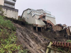
5. And that’s not all.
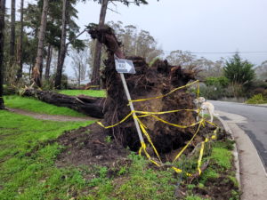
As residents of El Granada Blvd. can attest, the storms saturated the few remaining permeable surfaces and caused trees to fall and crush a house there, and mudslides undermined the foundation of homes on that steep hillside.
El Granada’s stormwater situation illustrates several problems present throughout the Midcoast:
a. The lack of a stormwater management system to collect, store, and or divert runoff in a safe manner.
b. The overbuilding of impermeable surfaces which concentrates water on the few remaining areas of soil, saturating the ground and weakening the hold of tree roots – thus allowing winds to blow them over.
c. The increased rainfall due to Climate Change, which has pushed the rudimentary stormwater infrastructure – sufficient in prior decades – past a Tipping Point, and threatens both homes and evacuation/first responder routes.
FOOTNOTES:
[1] Stormwater Definition: Stormwater runoff encompasses rain water runoff from both impermeable (streets, driveways, etc.) and permeable (landscaping, undeveloped lots/areas, etc.) surfaces as well as drainage from erosion control efforts.
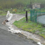
[2] Side Effects: This year, because of the quantity of flooding runoff after the January, 2023 storm, the Parks Department temporarily diverted all of the lesser flow down Columbus. This somewhat helped reduce the flooding down Santa Maria and its impact on homes, for which the residents are thankful. Nonetheless, the increased flooding from the diversion then adversely effected the safety of residents downstream on Columbus and resulted in dangerous water pooling at the intersection of Columbus and Santiago Ave. It also blocked the entrance to Quarry Park preventing use of the facility.
[3] Precedential Solution: Until a 2018-2019 Midcoast Drainage Project installed a catch basin at and underground piping along Ave. Cabrillo, runoff flooded above ground down Ave. Cabrillo to the storm drain at Ave. Alhambra as it still does above ground down Santa Maria to a pseudo drain at its end.
[4] Incomplete Effort: Another stormwater drainage project is next planned for Ferdinand Ave. but again, like Santa Maria Ave. flooding, it only addresses the problem from The Alameda to Ave. Alhambra. The project does not address runoff upstream from The Alameda to the sources of the flooding – leaving that stormwater to flood over residential streets and expose residents to continued safety fears.
 More From Gregg Dieguez ~ “InPerspective”
Mr. Dieguez is a native San Franciscan, longtime San Mateo County resident, and semi-retired entrepreneur who causes occasional controversy on the Coastside. He is Chair of the MCC, but his opinions here are his own, and not those of the Council. He lives in Montara. He loves a productive dialog in search of shared understanding. >>
<< Mr. Silveria has called the Midcoast his home, Half Moon Bay then El Granada, for all of his life – except when away to college. He started 1st grade in HMB then continued on to graduate from HMB High then on to the College of San Mateo and graduating from San Jose State in 1975, with advanced training over the years at additional NorCal schools – never far from home. He is now a retired Auditor trying to support his community of El Granada and the Midcoast he loves.



Well documented. Thank you! May we have the info regarding what happens next in the process to attempt to resolve this?