|
Getting your Trinity Audio player ready...
|
OWN VOICE. ~ InPerspective by Gregg Dieguez —
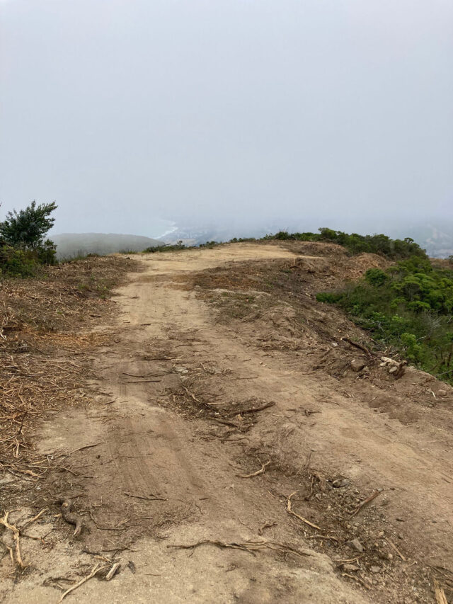
What started out as an understandable emergency priority may have turned into a lasting disaster. Early in June the San Mateo County Department of Emergency Management conducted emergency road repairs on Montara Mountain for a valid reason (supplying fuel to back up generators for a critical telecommunications installation). However, members of the community are incensed at the degree of earth movement and vegetation removal. The MCC was notified of that work shortly before planned efforts and the scope is documented in this article: https://www.coastsidebuzz.com/emergency-on-montara-mountain/ … and in attachments therein.
The MCC plans to hold a hearing on this matter at its June 28th regular meeting. If you have findings or concerns related to this matter, please write the MCC [midcoastcommunitycouncil@gmail.com] and/or come to speak at about 7:45pm. The details of the agenda and zoom access will be posted subsequently at http://midcoastcommunitycouncil.org/

This morning I parked at Grey Whale Cove and hiked a mile or so up the approaches to the mountain. I could not see a major problem, but found a loving memory in the bushes. [<Photo left] I ran into a veteran hiker who has been out of town for a month. He had not seen any damage, but he has only hiked as far up as “The Saddle”, the ridge with the road leading to the cell towers on one of the peaks. He remembered the 1999 incident where a utility truck trying to service equipment at the top, lost its way in the fog, drove off the road and the driver was killed. That was part of the impetus to repair access to the peak, as likely was the MCC analysis of communications vulnerabilities during the recent storms. Those towers contain essential communications gear for the Midcoast, including the ‘last resort’ gear used by CERT to relay HAM radio from neighborhoods in distress over the hill to the Office of Emergency Services, etc. The road was so damaged in recent rains that utility trucks could not deliver propane and diesel to backup generators atop the mountain, and we were thus one more PG&E power failure from total radio silence.
Local residents however, have seen major problems. Here are some quotes:
“I have been walking this road since McNee Ranch was opened to the public in 1985. In that time there have been numerous road maintenance efforts, sometimes effective briefly but usually demonstrating a lack of institutional knowledge, a failure to learn from previous efforts, and a lack of sensitivity to the park. In this description, there are good activities and bad. The most important thing to remember is that the troublesome erosion is caused by runoff on and from the road, itself. … Grading away the berm on the downhill side of the road will allow more runoff to saturate the topsoil and reach the interface between the topsoil and the granite rock beneath.” – comment on May 25th BEFORE work was done.
DEM reply to those comments, prior to work commencing:
“The comments [above] are aligned with our plans. Our operational priority is an emergency repair which slows the water down and sheds it off the road at appropriate locations and in an appropriate manner. We recognize that erosion has been the primary culprit and only smoothing of the road is not an answer. While the road conditions may not be exceptional, the gradual narrowing of the road and constant erosion has resulted in a current condition where emergency vehicles and fire trucks can no longer access the peak, where they could in past years. Additionally, we will only be reducing vegetation in the roadway as specified in the plan. Many areas of protected species have been identified where hand crews only will work on pruning minimally for safe passage. As for culvert repairs or improvements, they are beyond the scope of this emergency repair. That effort will be part of ATC’s undergrounding of lines which is in the permitting phase.”
Then on June 12th, after the repairs:
“I was up on the mountain yesterday (6/21), and saw evidence that a full size vehicle drove all the way up the trail to 4 corners, driving over many rare plants that are only in that area. It was beautifully scenic and tranquil, now it just looks run over and torn apart. Not really sure what’s going on, this seems to be a recent escalation of unregulated vehicular traffic in areas that are easily disrupted or destroyed. There needs to be some type of sensitivity and operational protocol on the mountain so that the natural environment is preserved and cared for. Many of the trails are too small for full size vehicles. Rangers should be using electric bikes on small trails, not full size vehicles.”
“The current grading of the road is being done with an obvious lack of awareness of the basic geology of the substrate on which the road was built. This knowledge of the decomposed granite and the thin soil layer (an A horizon roughly a foot thick where it exists on most of the mountainsides) is essential to what specific measures are done to control runoff from the road and associated erosion…. In a number of places, new or increased drainage ditches have been cut across (!) the road and cut through the vegetated shoulder to direct runoff onto the downhill slope. Not only will this increase the chance for new erosion gullies and possibly, in exceptional wet weather events, debris flows on the mountainsides, but they will quickly erode the road during significant storms and make passage on the road more difficult for vehicles. “
” All of the above concerns about the road itself can be addressed and ameliorated to some degree. But the greatest part of this disastrous damage is the entirely unnecessary and extensive damage to natural vegetation and ecological conditions far off the road, itself. It would take a book to describe the scope and consequences of what has been done. Was no competent naturalist present to inform and control the activities on the road?”
“Far from Mr. Barnett’s assurance that sensitive areas of plants along the road would be identified and protected, the destroyed areas along the roadsides included many areas of somewhat unique plant assemblages and some plants unique to Montara Mountain. By some botanical reckonings, coastal scrub and chaparral constitute two kinds of elfin forests, and this is certainly a useful way to view such vegetation on Montara mountain. Knocking off a few limbs here and there where they were overgrowing the edge of the road would have been reasonable, and this should be the task of regular road maintenance every few years. Well, we won’t have to worry about that for many years now.”
“- At various points, they clear-cut both sides of the existing trail to a degree that defies reason. If the goal was to make the road passable, why did they take a 10 foot wide road and clearcut 13 feet on the left side and another 2 feet on the right, resulting in a 25 foot wide path? What trucks are 25 feet wide?
– And in those some sections where they seemingly arbitrarily cut as much as possible, the road then narrows to 10 feet again because of a tree or a rock that can’t move. There are multiple examples of this. So right after a 25 foot wide section, the trail is back to 10 feet wide, which means that’s the theoretical limit for truck passage anyway.”
“There are a lot of old growth plants lost, unfortunately, and some of the beautiful areas probably won’t recover for decades. It doesn’t seem like very thoughtful or considered care for a treasured coastal and national park. I couldn’t imagine the same tree and plant shredding with little regard for the results happening in Golden Gate Park or Muir Woods.”
A gallery of before and after photos was provided by Mark Verlander: https://verlanderdesign.pixieset.com/montaramountain/
So, on the basis of comments like those, and many more, we are going to hold a hearing on this at the MCC.
I was wondering if more repairs are planned, to deal with the expressed concerns about drainage, etc., but yesterday received this reply from Dave Barnett of DEM:
” Gregg,
Emergency road repairs are completed which allows for a Type 3 Fire engine and service vehicles to access peak. The scope of future repairs and maintenance will be determined by the landowners including American Tower Corporation(ATC), CA State Parks, NCC Water District and NPS/GGNRA. ATC has submitted plans for undergrounding of lines includes road repairs. As SMC DEM is not involved in that permitting process, I cannot speak to status of application, timelines or scope of work that will be done under ATC’s plan. Other ongoing maintenance and repairs will be determined by landowners.
From here please direct questions to Don Mattei or David Cosgrave as the emergency road repair is competed.
Dave”
So, whatever we see is what we’ve got, at least for now. Scott Bollinger of the MCC is going to ascend the peak this weekend and take some photos and measurements and bring his findings to our discussion.
On a related note, you may recall when SFPUC chopped the top off Montara Mountain and residents and MWSD dragged them up to the peak to see the damage. Sean Handel reports as follows: “On a related note, I heard back from Tim Ramirez from SFPUC related to my most recent request to ask for a firm timeline on restoring and reopening Montara north peak. His response is pasted below:
“Hi Sean – still catching up on emails from being out the last two week, apologies for the slow response. Unfortunately I don’t have a schedule yet – I’ve asked for one from the project team, but haven’t heard back yet. Most of the key folks are out this week, back next. We haven’t even started our storm recovery projects yet, and that’s the priority right now – once we get schedules for these, we can see what else we have bandwidth for this week. Whatever the specifics, I’m happy to share these details once I get them.
I know this isn’t great news for you and others interested in this change – thanks for your patience. I’m available to get on the phone and talk if that would help, just let me know.
Thanks. ““
Thus, we will include a discussion of the lingering SFPUC damage as well at the MCC meeting next Wednesday, 6/28.
 More From Gregg Dieguez ~ InPerspective
Mr. Dieguez is a native San Franciscan, longtime San Mateo County resident, and semi-retired entrepreneur who causes occasional controversy on the Coastside. He is Chair of the MCC, but his opinions here are his own, and not those of the Council. In 2003 he co-founded MIT’s Clean Tech Program here in NorCal, which became MIT’s largest alumni speaker program. He lives in Montara. He loves a productive dialog in search of shared understanding.


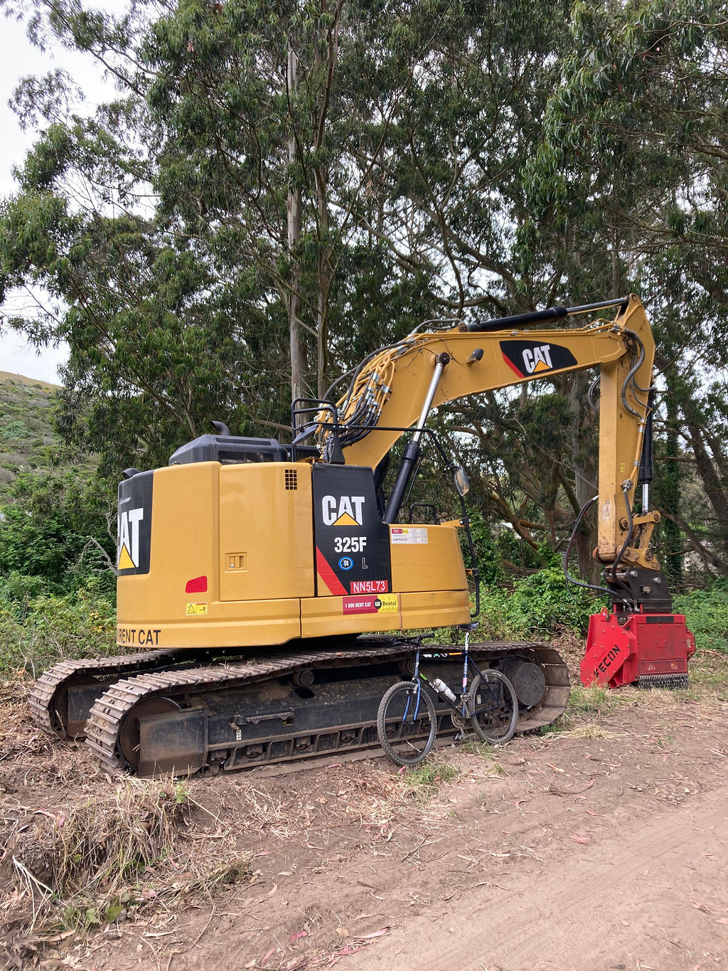
What disregard for sensitive and rare habitat. Yes, we need to put safety as a high priority, but we don’t have to completely disregard the environment while we do it. In fact, we shouldn’t, because destroying our environment directly impacts our own survival. The more we tear it down, the more we dry it out. The more we dry it out, the less rain that will come and the more severe weather it will bring. The most current research says that the bacteria from under the leaves of trees and plants seed the clouds. Really, we should be super careful to replace vegetation in other places if we have to take it out anywhere. Where is the balance? Let’s think things through more please.
Can’t please everyone, safety first folks . I drove those roads myself years ago when I drove a propane truck . It’s nice to see a decently wide road when you are crawling up or down those roads . The roads are slick gravel with ruts , can’t go fast so the wider makes it easier to navigate the ruts . These guys wanna go home at the end of the day too . It’s not wrong to have it be safer for them .
There are several problems with the above article. First is that there was no emergency situation on the road and the erosion on the road from last winters storms was no worse than it is and has been over many years and did not prevent vehicular access to the mountain top. Yes, maintenance of this road is necessary, and, yes, the road could have been improved in several short stretches where it is on the bedrock, but these were no more than the minor road issues that have existed for decades. A couple of times I have come upon injured or sick people several miles up on this road, and the emergency truck from Point Montara Fire Department had no trouble reaching them in response to emergency calls from me and other hikers. The flimsy rationale for this paid no serious attention to the other road routes to the top of Montara Mountain by way of Whiting Road or by way of the Perimeter Road which enters Whiting Road near the mountain top. The road in the “emergency” declaration is not the only route; and, in fact, the other roads have been used to access the mountain top by agencies in the past.
Gregg, I know of your concern for security of coastside communications, but nothing done during this ignorant environmental boondoggle improved that security one bit. A second factor in your personal report is that you did not even go to the affected areas in your field trip to the mountain. Even if you had done so, a mile up the mountain in the damaged areas would not have visited the majority of the damage or the greatest destruction of mostly natural places that make the natural features of Montara Mountain a natural preserve unlike any other in the coastal mountains of San Mateo County.
Mr. Barnett clearly had no understanding of what he was dealing with, either on the road or in the surrounding vegetation. There were many past road maintenance efforts, and the successes and failures of these projects and the grading techniques are well known. Mr. Barnett gives no indication he had any clue about these in his superficial rationale for the project. But for quantity of information, the knowledge of the vegetation on the mountain that has been severely damaged by the road project (the photos you have seen show only a few examples of much more extensive damage) is even more robust. Roger Raiche and Darryl Wright of the U.C. Botanical Garden led a team of botanists that conducted and reported an extensive survey of species and plant communities in the mid-1980’s. Other plant surveys of varying sizes on the lower slopes were done as part of the bypass controversy in the 1980’s and 1990’s or more recently by person’s associated with the California Native Plant Society. For the former, I’ll mention the survey by plant taxonomist Mike Vasey of areas damaged by Caltrans while creating unpermitted pioneer roads in 1985; this became part of testimony to San Mateo County authorities and resulted in the cessation of that Caltrans activity and required restoration efforts insofar as they could be tried. For the more purely botanical surveys of several sizes, I’ll first mention Chuck Kozak’s excellent mountain-encompassing roundup of the late 1990’s, which can still be seen on Montara.com. Of the others, one that should be of particular interest to plant enthusiasts who don’t venture beyond trails close to the trailheads is that by botanist Toni Corelli for the Gray Whale Cove Trail. Records of species by Chuck, Toni, and many others can also be found online at Calflora.org. For decades and over a number of editions, records of vegetation on Montara Mountain have been noted in *A Manual of California Vegetation* published by the California Native Plant Society; an online version of this manual is available at https://vegetation.cnps.org. The kinds of vegetation found on Montara Mountain were earlier covered in John Thomas’s locally classic *Flora of the Santa Cruz Mountains*, among a number of other reference volumes. Mr. Barnett and whomever consulted with him on the road bludgeoning seemingly knew nothing nor cared about any of this when they blundered ahead. When pushing a pet project, it’s best to avoid learning about what one doesn’t know. There was no excuse for their obvious ignorance when they concocted their “emergency.”