|
Getting your Trinity Audio player ready...
|
SAN MATEO COUNTY PLANS for Connect the Coastside (CTC)
CTC Final Administrative Draft
Description
Recommended California Coastal Trail alignment and improvements in the Midcoast including:
- wayfinding signage.
- Class I Path
- Class III Bike Route
- sidewalks
- trails
- paths
Source
Highway 1 Safety and Mobility Improvement Study Phase 2 (p.24-27), Connect the Coastside
Rationale
Traffic safety and multimodal circulation concern – implementing appropriate signage, marked crossings, sidewalks, bike routes, and other infrastructure to define the alignment and access points for the California Coastal Trail, improving circulation and safety for this important Midcoast destination.
Location
Various streets and trails between Point San Pedro (north of Devil’s Slide Trail) and Half Moon Bay Coastal Trail
Discussion
The California Coastal Trail (CCT) is envisioned as a continuous, interconnected public trail system spanning over 1,200 miles from Oregon to Mexico made up of a network of public trails, streets, and bikeways for walkers, bikers, equestrians, wheelchair riders and others along the coastline. In the Midcoast, the planned CCT route is approximately 10 miles long from Point San Pedro to Half Moon Bay. Some sections of the Midcoast CCT trail alignment have been built and each section’s configuration varies considerably. In some areas, it traverses roadways on the land-side of Highway 1, such as in Montara where it is designated on Pedro Mountain Road, and in others it is an earthen bluff-top hiking trail, such as in Pillar Point Bluff, a San Mateo County Park.
The CCT is and continues to be an important destination for residents and visitors. Defining a preferred alignment and adding infrastructure to support trail use and access (e.g., marked crossings, sidewalks, and paths where needed) will create safer conditions for trail users and more predictable conditions for motorists.
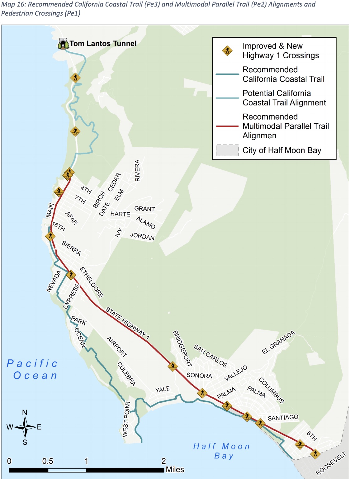
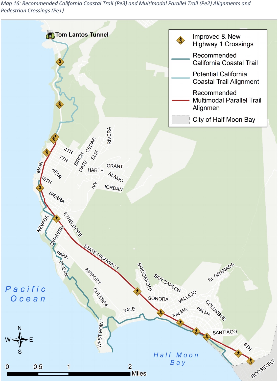
Connect the Coastside recommends a Midcoast CCT alignment as shown in the map below, with an emphasis on completing sections that overlap with multimodal transportation needs (south of Highway 1 and 1st Street). Where the alignment of the trail is on local roads, Connect the Coastside recommends a combination of decomposed granite paths (if sidewalks are not present), with Class III Bikeway and wayfinding signage.
In some areas, new paths would need to be constructed (such as connecting the two ends of Vallemar Street in Moss Beach). In some cases, the alignment overlaps with other recommended projects (such as the Multimodal Parallel Trail (Pe2)); recommended improvements are described in those projects.
Alternate alignments of the CCT from path erosion due to sea level rise would need to be considered in a future planning study recommended by this Plan.
Final Administrative Draft of Connect the Coastside Released By San Mateo County
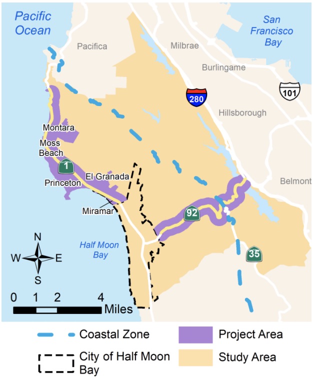
Please join us for a review and discussion of the updates to the plan at the January 27, 2021 meeting of the Midcoast Community Council. We look forward to your feedback on the updated Plan and if it reflects what we heard during the 2020 outreach efforts (see the 2020 Outreach Summary Report for a summary of what we heard and the proposed changes to the plan).
CTC Final Administrative Draft
We also invite you to join us for a February 10, 2021 San Mateo County Planning Commission meeting for a review and discussion of the updated Plan.
Thank you for your continued participation in Connect the Coastside and we look forward to staying in touch.
Sincerely,
Katie Faulkner, Planner III, County of San Mateo, Planning and Building Department
