|
Getting your Trinity Audio player ready...
|

An application has been submitted by Bayland Soil Pacifica LLC for approval of a quarry reclamation plan. The application is known as File No. 2016-001 and includes Quarry Use Permit UP-71-16.
An approved quarry reclamation plan will allow the former quarry to be reclaimed as required by Title 9, Chapter 2 of the Pacifica Municipal Code and by the California Surface Mining and Reclamation Act (SMARA). The quarry is located west of the intersection of Coast Highway and Reina del Mar Avenue.
Frequently Asked Questions (FAQ) about the Rockaway Quarry Reclamation Plan
Application materials and other information are posted here. The application is complete and the City is evaluating potential impacts under the California Environmental Quality Act (CEQA).
Application Materials
Development Permit Application
Reclamation Plan (Combined Document with Attachments – 300+ MB)
Draft Environmental Impact Report available for public review and comment.
Questions?
Please contact Deputy Director Christian Murdock at cmurdock@pacifica.gov or (650) 738-7444 with any questions you may have about the reclamation plan.
The Pacifica Quarry was a side hill, open pit mine from which limestone, greenstone, shale and chert were harvested, crushed, screened and sold for construction purposes. Mining ceased in 1987 and the Quarry has been the site of a variety of uses and development proposals since then. Notwithstanding any future development, though, the State Mining and Reclamation Act (SMARA) of 1975, as amended, requires that the mine be reclaimed. More specifically, SMARA states that, “reclamation of mined lands is necessary to prevent or minimize adverse effects on the environment and to protect the public health and safety…and that mined lands are reclaimed to a usable condition which is readily adaptable for alternative land uses” (Sect. 2710).
This Reclamation Plan was prepared pursuant to SMARA and the City of Pacifica Mining and Reclamation Ordinance. The Plan is organized in the same fashion as the 1998 Pacifica Quarry Reclamation Plan, the most recent Plan approved by the City, with additional discussion as derived from the “Reclamation Plan Review Checklist” of the California Department of Conservation’s Office of Mine Reclamation (OMR). This Reclamation Plan comprises the final grading, drainage and environmental protection measures required to leave the site in a condition that is safe, stable and readily adaptable to alternate land uses in conformance with SMARA.
History
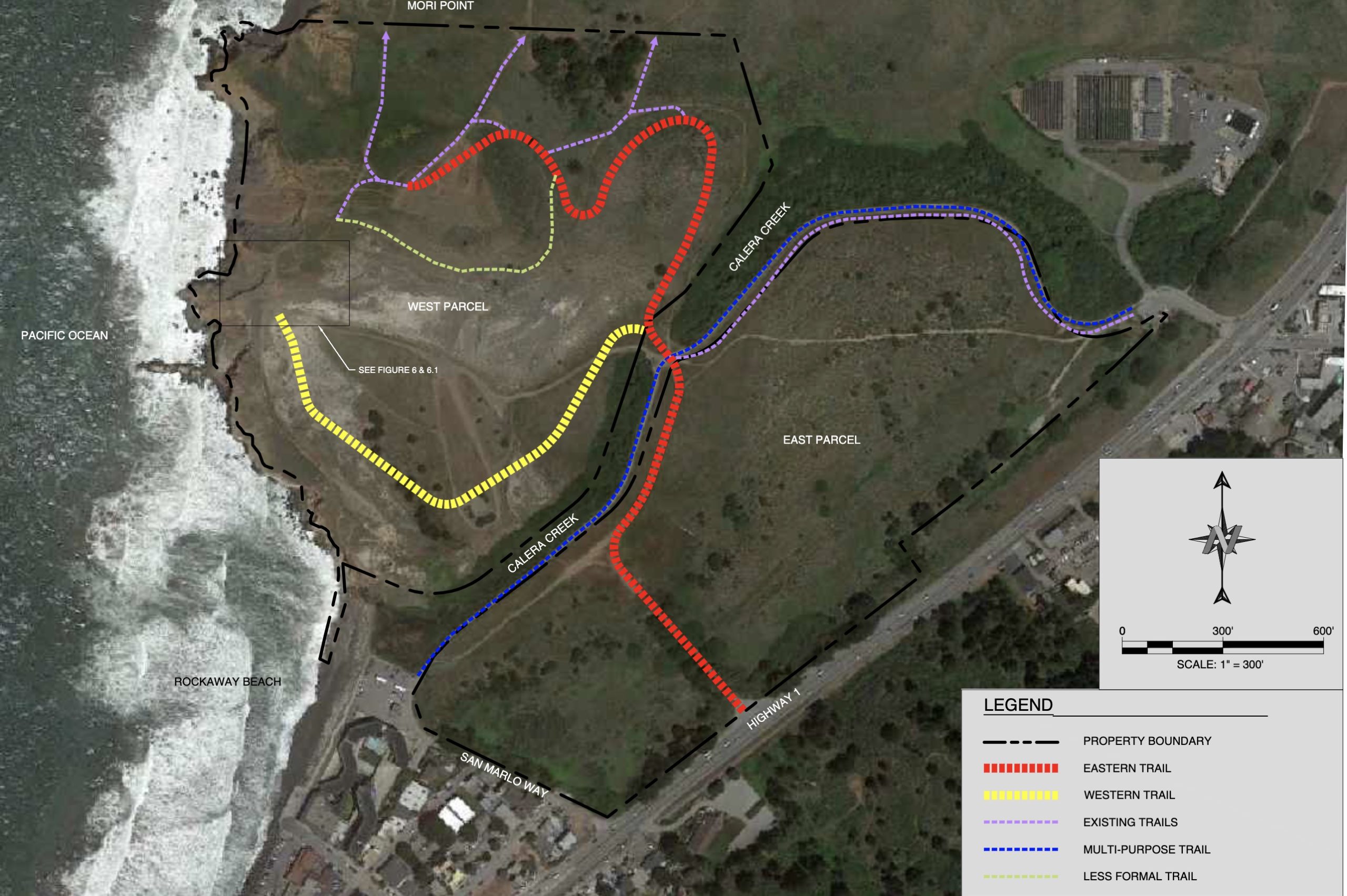
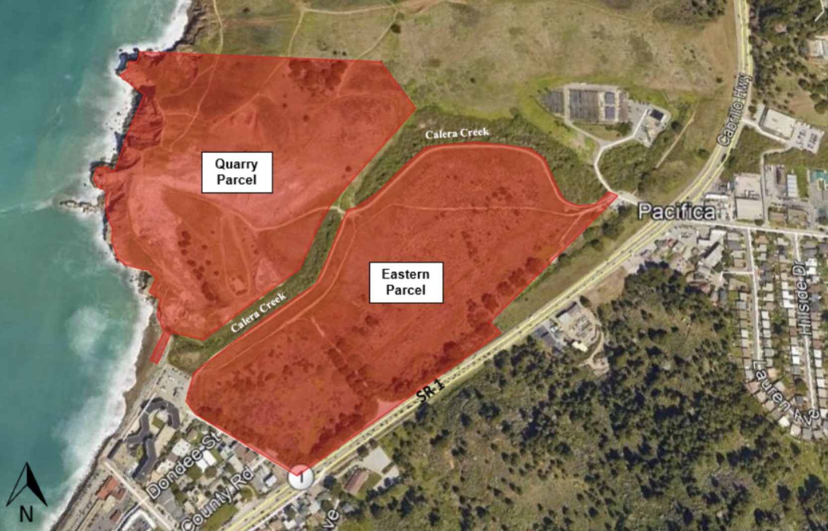
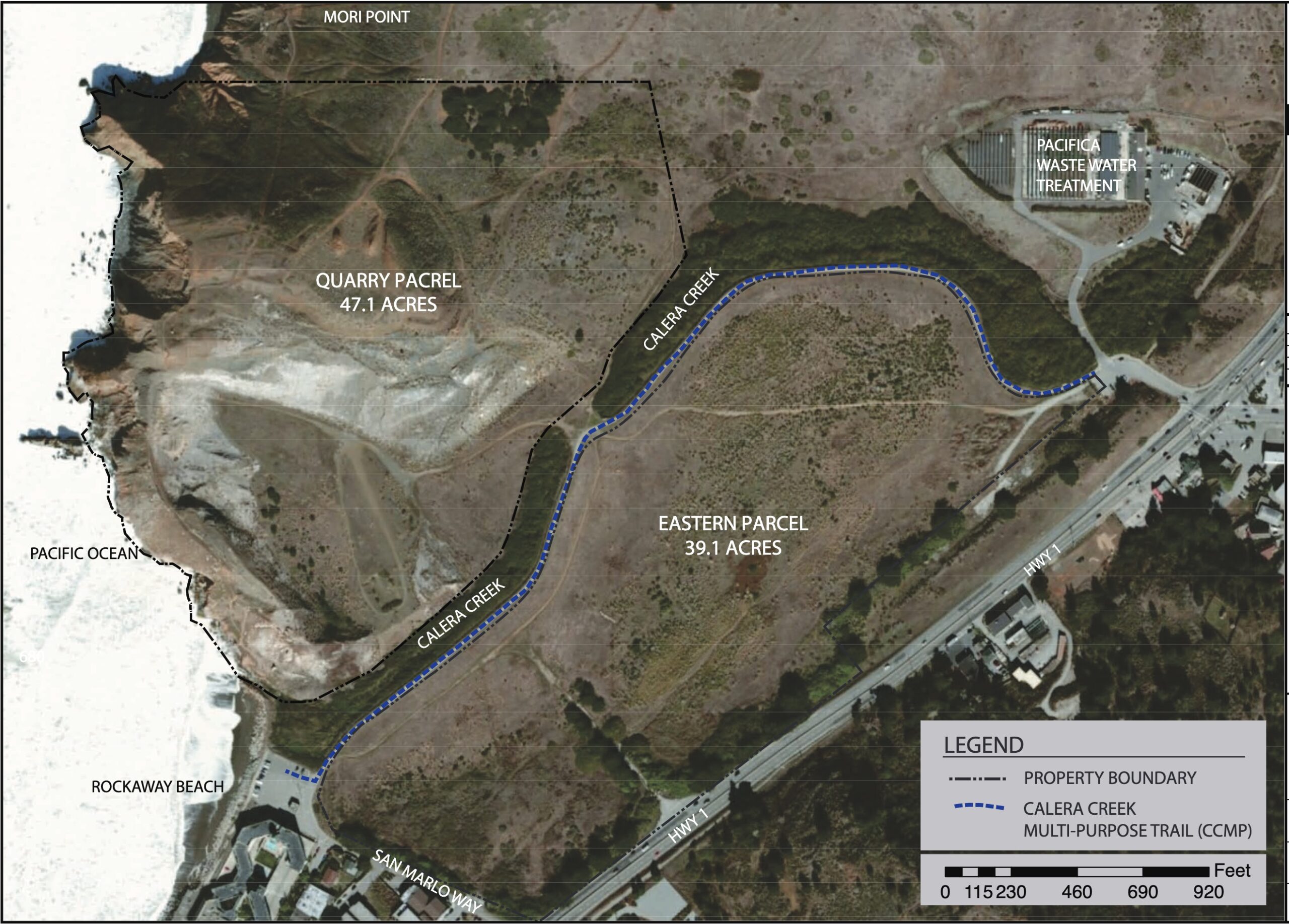
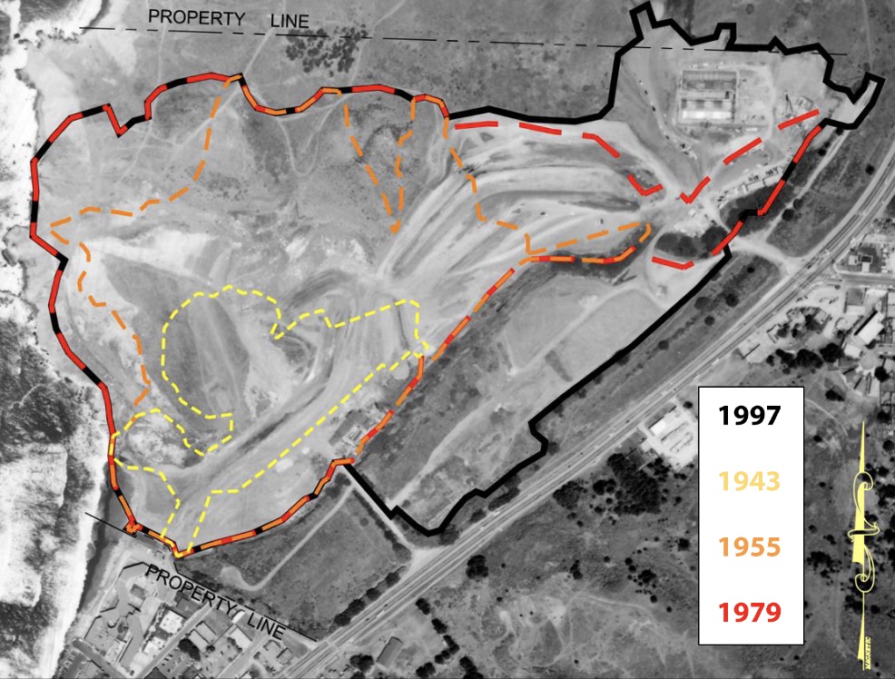
The Pacifica Quarry property is divisible between the Quarry (western) parcel of 47.1 acres and the Flats (eastern) parcel of 39.1 acres. This Reclamation Plan considers both Quarry Parcels (86.2 acres total). The eastern parcel will contain temporary access for construction equipment and materials, along a specified route and creation of a wetland as mitigation for wetland loss on the western parcel. Although the eastern parcel was used in support of Quarry operations and has been significantly disturbed, it has already been partially reclaimed by the City of Pacifica as part of its work in 1999-2000 (see below for more detail).
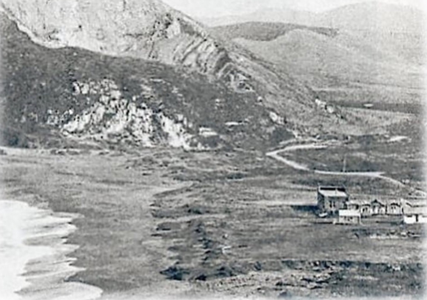
The Quarry property has seen active use since at least the mid-1700s when Spanish soldiers quarried lime here for the Presidio in San Francisco (Quarry Products 1976).
There is some evidence that the Ohlone mined this area as well. Under the ownership of the E. B. and A. L. Stone Company, it supplied limestone for the rebuilding of San Francisco after the 1906 earthquake. From 1907-1920, the Ocean Shore Railroad ran through the site on its way to San Francisco. Extensive blasting was used in support of the mining in the 1920’s and 1930’s until the blasting was halted by court order (Hunter 1997). While the Quarry was actively mined from 1900 on, the eastern parcel was used for buildings and settling ponds, quarry roads, conveyor belts a truck scale and washing area. These uses were “obliterated” and the parcel “filled by 1993” (Aquifer Sciences 2001); the City-approved 1998 Reclamation Plan excluded this parcel from the reclamation area, indicating that reclamation was considered complete there.
By the 1970’s, though, mining declined as the demand for limestone decreased. The last commercial operator, Quarry Products, Inc. closed the quarry in 1987. Subsequently, the quarry pit was partially filled with earth taken from the Vallemar Road cut created to expand Highway 1 (Holman & Associates 2002).
Once the quarry operations were suspended, the property was used for a variety of enterprises, including an annual rodeo. However, in 1996, the City received permits to construct a wastewater treatment and recycling facility on the north edge of the property. These permits also allowed the City to relocate Calera Creek, which had been a man-made ditch running through the center of the eastern parcel to a new, separate parcel of 17.21 acres running between the Quarry parcel and the eastern parcel. As part of these permits, the City also agreed to grade the eastern parcel and to fill “the old channelized creek [and] 7+ acres of previously damaged and scattered wetlands on site “(Coastal Commission Coastal Development Permit 1-95-40).
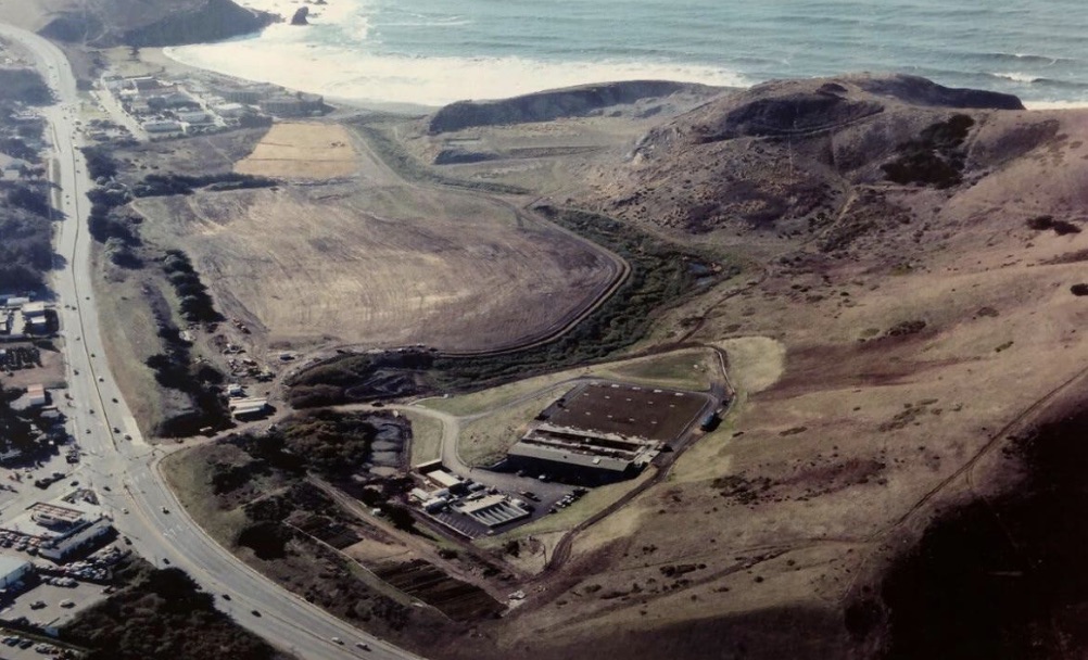
Photo 1 shows the property in 2000, shortly after the treatment plant was built and the eastern parcel graded.






Good to know.