|
Getting your Trinity Audio player ready...
|
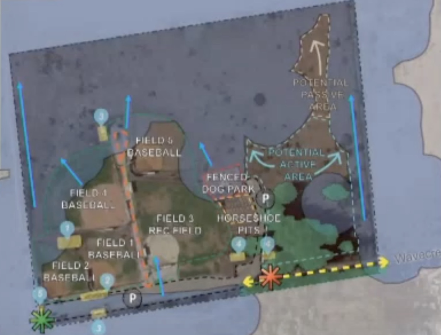
VIDEO. From the City of Half Moon Bay City Council’s Annual Special Priority Setting workshop on Tuesday, March 22nd, 2022 at 7:00pm by Zoom.
Deputy City Manager, Matthew Chidester, asks for clarification from City Council. Mayor, Debbie Ruddock, responds.
OneShoreline
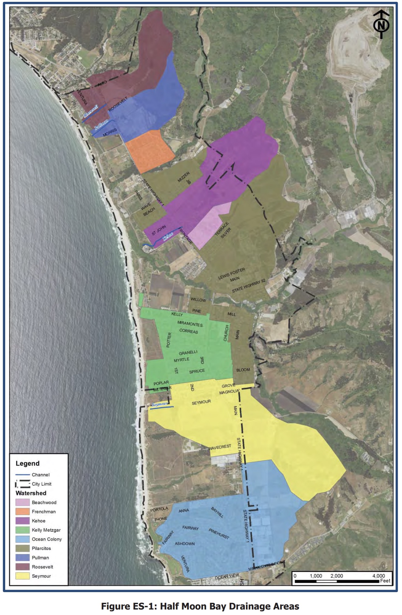
City HMB 2016 Storm Water Management
City HMB Watershed and Monitoring
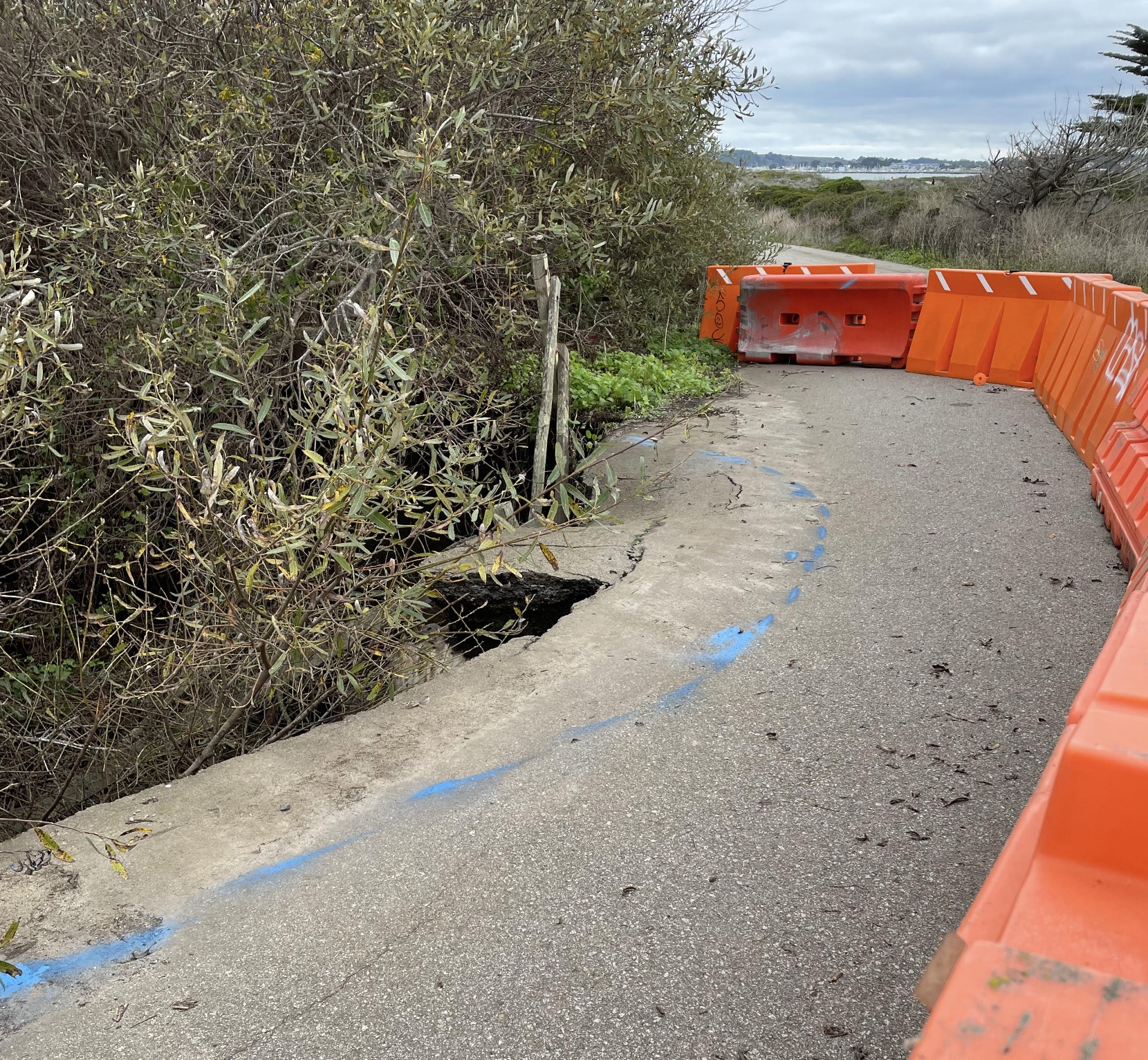
Roosevelt Ditch Collapses Access to Roosevelt Beach After Storm…Coastal Trail Next?
OWN VOICE. I don’t own a car. I don’t like driving or traffic. I moved here in 1989 from over-the-hill and stopped commuting in 1991, choosing to work locally… and ride my bike to work.
I like to ride bikes. I have around 60,000 miles on the Coastal Trail. I am not the only one. Sure there are recreational users, but farmworkers and hospitality workers go from Pillar Ridge Manufactured Home Park (227 homes), south to Half Moon Bay and back.
Over those miles and those years we have had a TWO YEAR detour around the California State Park Pilarcitos Bridge. First, it was made of the wrong metal and because a State Park Ranger drove a tractor over the bridge in 2014 (HMB Review) .
Who to Contact?
Bruce Meyer, Supervisor at California State Parks
Bruce.Meyer@parks.ca.gov
Update as of 12/23/2021 from Bruce. “One of my staff drove down to monitor on the culvert and drove on the edge. I have instructed all staff to stay off the trail. The blue line signifies how far the road has been undercut. I am not involved with the planning, but I do know that this is of the highest priority.”
The Roosevelt ditch/culvert is just as vital as the County’s Medio de Arroyo bridge which is closed for a year and a half.
More on the Medio Bridge on Coastside Buzz
City Council of Half Moon Bay Meets ~ 1st and 3rd Tuesdays at 7:00pm

HMB City Council Agendas and Zoom Links
HMB City Calendar
The New Now ~ Virtual Remote Public Agency Meetings
- streamed live on Comcast Channel 27 and Pacific Coast TV website
- the City’s website online (via Granicus)
- and on Facebook Live
- one in English (City of Half Moon Bay FB Page)
- one in Spanish (City of Half Moon Bay Recreation FB Page)
- Recorded by Pacific Coast TV (PCTV)
Members or the public are welcome to submit comments (in accordance with the three-minute per speaker limit) via email
 ing – (650) 477-4963 (English) and (650) 445-3090 (Spanish).
