|
Getting your Trinity Audio player ready...
|
ARTICLES and VIDEO. From “KSBY: California’s Central Coast” on Nov 16th, 2023 and the County of San Luis Obispo.
Helicopters with hoops to collect data around the Central Coast
From “KSBY: California’s Central Coast” on Nov 16th, 2023. By: Claudia Buccio
Paso Basin Aerial Groundwater Mapping Pilot Study
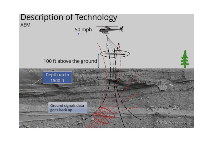
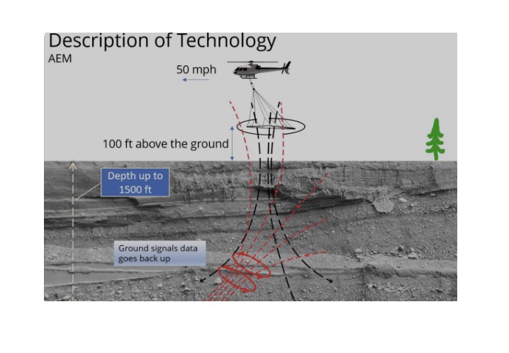
The County of San Luis Obispo was selected for a pilot study to collect geophysical mapping data in a portion of the Paso Robles Basin (click for map of study area). The successful pilot study used innovative technology called Aerial Electromagnetic Method (AEM) to collect geophysical data in the Paso Robles Basin. The data from this pilot study will be used to enhance groundwater modeling efforts and provide a better picture of our groundwater system.



I think we have lots of studies that tell us where water is and delineate potential sources. We should probably look at what we have prior to throwing new technology at it.