|
Getting your Trinity Audio player ready...
|
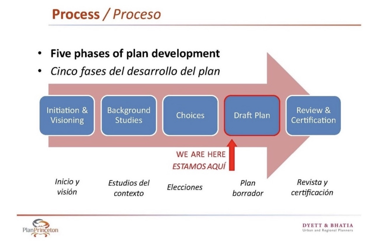
PUBLIC COMMENT OPEN. San Mateo County Planning’s Plan Princeton Land Use Plan is back up for consideration. Another staff member has been recruited to help keep it moving along, with the goal to have the final draft towards the end of this year, 2022.
For Plan Princeton we are looking at current modeling and science to ensure the data we are using is up-to-date, including reliance on current Our Coast Our Future models which incorporate USGS’s latest SLR (Sea Level Rise) CoSMoS Modeling efforts (Coastal Storm Modeling System).
Once we have a draft together based on latest science and State guidances, we’ll be ready to share it with the public at a public venue.
If you have any particular/specific concerns or suggestions, please submit them in so we can take them into consideration when we start developing draft policies. ~ Princeton Plan Project Planner, Summer Burlison.
Comments:
The Project Planner is still Summer Burlison ~ [email protected]
Plan Princeton from the Midcoast Community Council (MCC) website
County Project Webpage
MCC Princeton Shoreline page
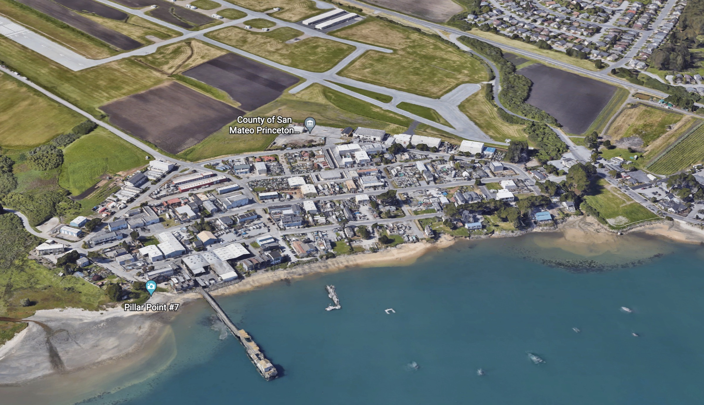
The area comprised of Princeton, Pillar Point Harbor and the Half Moon Bay Airport is the visitor-serving and industrial hub of the Midcoast. In 2013 the County began a comprehensive planning update for the Princeton area to update existing land use plans, development polices and zoning regulations.

Plan Princeton study area
Project planner: Summer Burlison
Scope of Work
Public Participation Program
Coastal Act Background & Requirements
GOALS OF PLANNING UPDATE:
-
Enhance coastal access, recreation, research, and education opportunities.
-
Support and expand coastal-dependent and coastal-related uses.
-
Provide facilities needed by the commercial fishing industry and recreational boaters.
-
Create local jobs and services.
-
Abate neighborhood blight and zoning violations.
-
Address parking, circulation, and infrastructure needs.
-
Identify and evaluate potential solutions to shoreline erosion problems.
-
Protect and restore water quality and sensitive habitats.
-
Maintain compliance with CA Coastal Act and State airport compatibility requirements.
MCC EARLY EFFORTS
-
2009 MCC and Pillar Ridge request for updated M-1 zoning regulations and Supervisor Gordon reply.
-
2012 MCC request/presentation to prioritize zoning updates for Princeton light industrial districts (M-1 and W).
-
2013 Pillar Point Harbor Shoreline Erosion MCC presentation
-
2014 MCC Overview Presentation on shoreline conditions, past and existing development, approved projects on appeal or not yet built
TIMELINE & PROGRESS OF PLAN PRINCETON:
2013 Community Visioning Report
2014 May: Existing Conditions Report
2014 Sept: Alternatives Workbook – comments by MCC — CCC
2015 Preferred Plan & Policy Framework – presentations to MCC – Planning Commission – comments by CCC — CGF —
comments on Development Standards Oct 2015 by MCC
>> 2016-2020 Project paused. <<
2017 – MCC requested status update — see 7/12/17 minutes #4a, although imminent roll out did not occur.
2019 Princeton Shoreline Management Plan – County policy framework memo to CCC & attachments — 2020 CCC reply: positive feedback on proposed water levels, erosion rates, and policy framework
Background
AIRPORT PLAN UPDATES
For info on 2014 updates of the Half Moon Bay Airport Land Use Compatibility Plan (ALUCP) and the HMB Airport Layout Plan, see Airport page.
ZONING ORDINANCES 2012
A-O Airport Overlay District
M-1 – light industrial District (airport & west of Airport St.)
W – Waterfront District – marine-related light industrial
CCR – Coastside Commercial Recreation District
ZONING MAPS
Midcoast Land Use Plan
Pillar Point & Marsh
Princeton
Harbor/Princeton Overview
LAND USE PLANS
Plan Princeton is a study being conducted by San Mateo County to update the land use plan for Princeton. The project will focus on the area west of and including Highway 1, between Pillar Point Harbor and Moss Beach. The purpose of this project is to make a comprehensive update to the policies, plans, and standards regulating the Princeton study area in order to:
- Enhance coastal access, recreation, research, and education opportunities.
- Support and expand coastal-dependent and coastal-related uses.
- Provide facilities needed by the commercial fishing industry and recreational boaters.
- Create local jobs and services.
- Abate neighborhood blight and zoning violations.
- Address parking, circulation, and infrastructure needs.
- Identify and evaluate potential solutions to shoreline erosion problems.
- Protect and restore water quality and sensitive habitats.
- Maintain compliance with the State Coastal Act and State airport compatibility requirements.
We need your ideas and input to develop a Plan that’s right for Princeton!
Project Schedule
Plan Princeton Summary of Community Workshop #3: Preferred Plan, June 2015
[pdf-embedder url=”https://www.coastsidebuzz.com/wp-content/uploads/2022/07/community_workshop_3.pdf”]
Plan Princeton Water Level Considerations Date: Tuesday, February 04, 2020
[pdf-embedder url=”https://www.coastsidebuzz.com/wp-content/uploads/2022/07/2020-02-04-Princeton-shore-CCC-comments.pdf”]
Princeton Plan so out of date Romeo Pier is still there
Other Princeton Harbor Stories on Coastside Buzz
The Princeton Ring ~ Saltwater, Heated Community Pool in HMB?!
Romeo Pier’s Last Bite >>> The Princeton Ring’s Debut?!
HMB History Association’s Coastside Chronicles ~ Frank P. Brophy and the Princeton-by-the-Sea Beach Resort


