|
Getting your Trinity Audio player ready...
|
OWN VOICE. ~ InPerspective by Gregg Dieguez and Michelle Dragony —
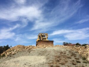
This story was originally going to be titled “The Rape of Montara Mountain”, but developments this past week make for a far more inspiring tale, in which a troupe of motivated local citizen activists not only turned back the bulldozers of the San Francisco Public Utilities Commission (SFPUC) who took the top off Montara Mountain, but got them to agree to put it back… Maybe…
Images: most will enlarge for improved readability in a new window when you click on them.
There are 3 aspects to this story, which is a long article, so use these links to jump to the items you care most about:
What happened?
What caused the change of heart at SFPUC?
What should we learn from this experience?
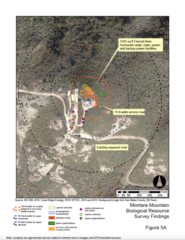
SFPUC developed plans for improved weather monitoring and rain prediction for the top of Montara Mountain in 2019. They produced a “Mitigated Negative Declaration” document on June 12, 2019 stating that impact to the environment was minimal. The goal of the SFPUC project (the Advanced Quantitative Precipitation Information (AQPI) system) was to install replacement of an existing radio system with high definition radar designed to improve the accuracy of rainfall forecasts for the Bay Area Region. This is a logical need given the drought we are again in, and are likely to face on an ongoing basis.

In July, 2019 Sean Handel discovered during one of his regular Tuesday night runs that fences had been erected atop the north peak of Montara Mountain, preventing access to the peak. He posted those photos on a Facebook page and that was when Michelle Dragony first heard of the closure. There had been no community notice about the project that reached Sean or anyone else he knew. Sean heard that there was an upcoming meeting at SFPUC to approve the new project. He read the NegDec and was astounded that they claimed that there was no impact to existing recreational use or the view from the peak, “So I put together a presentation on my experience on the mountain and presented it at the SFPUC meeting.” Steve Ritchie, SFPUC Assistant General Manager for Water, made it sound to the commissioners and the public that the gate closing off peak access was a separate issue – due to endangered butterfly habitat – and should not be discussed as part of the AQPI project. There is a strong local suspicion that the fencing was never about any butterflies, but rather about closing off access to SFPUC lands to the public. The butterfly claim lulled residents to inaction. The greater threat was not yet appreciated.
While SFPUC approved the project in August, 2019, it also tasked Steve Ritchie and Tim Ramirez (Natural Resources and Lands Management Division Manager) to work with the community to find a way to preserve some of the views. Sean and some other members of the Coastside Running Club met with them on Aug. 26th, and SFPUC proposed an alternate viewing location, a nearby hill that wasn’t the peak. And from that hill, the 360° view was obstructed on one side by the peak itself.
Sean also contacted the MCC and lobbied the San Mateo County (SMC) Planning Commission (PC) at their 8/28/19 hearing on the project. The agenda item was specifically to determine that the project conforms to the County General Plan. Staff explained to the PC that this project of a government agency of the City of SF is exempt from SMC building and zoning regulations (per US intergovernmental immunity doctrine), that the only requirement is a determination of conformity with the County General Plan, and even that is only advisory. The staff report provided to the PC did not mention the trail, but the public brought the issue to light. The PC then voted 5-0 that the project did NOT conform to the County General Plan based on the new public access restrictions. Notably, Planning staff was apparently unaware that the project is within the County’s Coastal Zone where the Coastal Act takes precedence over intergovernmental immunity.
And at the MCC meeting that same night, the MCC approved a letter to the SFPUC expressing the community’s concerns and a desire to work collaboratively to resolve the issue. Note that the SMC Planning Commission has staff analysis in other staff reports, some excerpts of which explain one issue:
It is important to note that because the proposed project is a public project by an agency of the City of San Francisco, the principles of intergovernmental immunity apply, and therefore no San Mateo County building permits or other development approvals are required for this project, and San Mateo County has no authority to prohibit or require modifications to the project based on development regulations…. A conclusion that the project is inconsistent with the County’s General Plan is unlikely to preclude the SFPUC from proceeding with the project due to the principles of intergovernmental immunity, and this interpretation is supported by case law.
Sean’s email to Supvr. Horsley yielded a response saying the project was on SFPUC lands – so San Mateo County had no jurisdiction, which is consistent with staff’s analysis. Sean’s email to the California Coastal Commission resulted in no action. Local resident Katie Sanborn rode to the top of the peak, and publicized the closure in an article in the HMB Review.
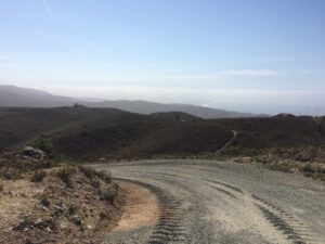
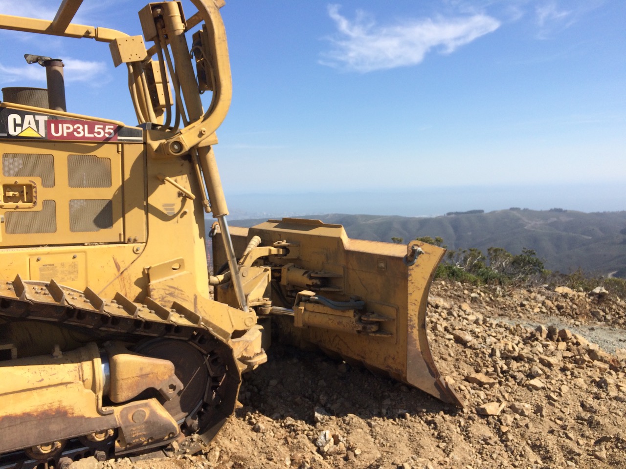
When SFPUC started work, they built a new road on the SF watershed side. Then they razed the top of the mountain. When he saw what they had done to the north peak of Montara, Sean was astounded and saddened. They had cut off the top, leveled it out, cleared out a bunch of plants and brush, and were getting ready to pour concrete. And the area they cleared was much larger than shown in their plans.
Our story continues in October, 2020, when local hiker, biker and photographer/graphic artist, Mark Verlander also noticed that SFPUC had not only fenced off the top of Montara Mountain, but had leveled it by about 10 feet and removed the historical markers. He photographed the damage and the SFPUC equipment and wrote Clay Lambert of the HMB Review, with pictures, which resulted in an article in the HMB Review on Oct. 21st. Director Jim Harvey of Montara Water and Sanitary District noticed the article and asked the GM, Clemens Heldmaier, to put the item on the MWSD board agenda. Because a water-related project by a neighboring water agency (SFPUC) was within MWSD’s watershed, and located at the headwaters of Montara Creek, MWSD got involved.

MWSD held a regular board meeting which covered the mountain topping on Nov. 5th, 2020, where Mark presented some of his photos and alternative plan drawings. Attendee reaction was immediate, and negative. Clemens then contacted SFPUC and invited them to attend a subsequent meeting at MWSD on Nov. 19th, 2020. He also contacted the County and the Coastal Commission and the Native American Heritage Council. At the second meeting, SFPUC project manager Tim Ramirez faced the music of concerned citizens and admitted removing the historical marker had been a mistake, but defended the SFPUC process. After the meeting Clemens contacted his boss, Steve Ritchie.
On Tuesday, Dec. 1st Clemens, and Directors Scott Boyd and Jim Harvey, together with Mssrs. Handel and Verlander and Tim Ramirez and Steve Ritchie of SFPUC met at the peak project site to inspect and discuss the matter. Following that meeting, Mr. Ritchie wrote GM Heldmaier agreeing to cease all construction, button up the site for the winter, consider a relocation of the project, create authorized public access, and stay in touch with coastal stakeholders.
What caused the change of heart at SFPUC?

Clearly, the change in SFPUC plans was driven by concerned local citizenry. However, why did social pressure work, when votes and letters by the County Planning Commission and the MCC had previously objected to the project, but not stopped it? When prior resident complaints went unaddressed? We can understand several legal bases, which, when coupled with tactful yet persistent pressure from MWSD, led SFPUC to realize their project had violated due process:
1. The project was in the Coastal Zone and not approved by the Coastal Commission.
Probably the most severe due process oversight is that part of the AQPI project is within the coastal zone and therefore requires a CDP (Coastal Development Permit) or other coastal input. This is wrongly stated in the NegDec report, along with, for example, that HWY 1 is not visible from the peak – another criterion for CCC (California Coastal Commission) involvement. Despite the SMC Planning Commission staff analysis excerpted above, when consulted, Lennie Roberts of Green Foothills wrote the following:
…in the case of the Montara Mountain project, most if not all of the project area was within the County’s Coastal Zone, and the cited intergovernmental immunity does not apply within the Coastal Zone. Coastal Act Section 30003 states: “All public agencies and all federal agencies, to the extent possible under federal law or regulations or the United States Constitution, shall comply with the provisions of this division.
There is still a remedy. If a complaint is filed, San Mateo County Planning would need to issue an after-the-fact Coastal Development Permit for the grading and analysis needs to be done as to whether there are special status species in the area. An after-the-fact permit would be appealable to the Coastal Commission as the new weather tower and replacement of existing tower radio system is “development’ under the Coastal Act, and this development is not the principal permitted use in the RM-CZ/DR/CD.
I will send a letter to County Planning and Coastal Staff.”
On the day MWSD, local citizens and SFPUC staff met atop the peak, it was clear from visual inspection on site and County maps that the project site WAS within the Coastal Zone.
2. SFPUC hid the full environmental impact of the project. The SFPUC Mitigated Negative Declaration (NegDec) was significantly flawed. That document did not mention that the project was in the coastal zone. There is no clear description of the radar unit in the NegDec, and the site plan is quite frankly not anything MWSD or SMC would accept as plans for even a simple single family housing development. In particular, the grading described in the Mitigated Negative Declaration stated:
Approximately 2,000 square feet of vegetation would be cleared for installation of an access road and components at the project site. A 15-foot-wide by 150-foot-long access road would be graded from the existing unpaved access road from the adjacent, existing facility to the project site. The project site would also be graded and leveled. The maximum depth of grading would vary based on existing topography (between 6 and 24 inches maximum). Excavation would be kept to a minimum wherever possible.”
However, observers estimate the reduction in mountaintop height at between 7 and 10 feet, not the “24 inches maximum”.
An unclear negdec is a problem in itself according to the California Environmental Quality Act (CEQA). Despite the County staff not understanding the exact location (which was shown as away from the immediate peak in county planning staff report), and the fact that significant grading was intended, SMC planning still voted 5:0 against the project.
The flawed NegDec could also have been the reason for the limited input they received from the Native American Heritage Council (NAHC), which has pretty broad rights to protect heritage sites, like mountain tops. If that group had understood the full scope of the project including the road, the NAHC might have commented differently.
The Coastside was left with the impression that the mountain top was closed for nature protection. Whether that was intentional or not, it is clear that this was the communities’ impression, and was also stated at the SFPUC meetings Sean attended last year. This deceptive approach might really be the biggest issue regarding the project.
3. Further, it is possible that SFPUC hid the full impact of the project by “piecemealing” the effort into separate projects, one for the road expansion to get equipment to the top, and another for the installation of the new monitoring equipment. CEQA generally prohibits an agency from “chopping up” a large project into little ones, each of which might have individually minimal environmental consequences, but which collectively may have significant environmental impacts. This “chopping up” of a large project is known as “piecemealing.” No grading permit was issued for the access road on the east side of the mountain. The associated road that was built (it’s a cut through one side of the mountain top now giving a direct connection between the SFPUC watershed service road and the mountain peak) was not mentioned in the NegDec.
4. Residents had a Prescriptive Easement to recreate on Montara Mountain.
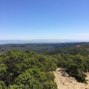
A prescriptive easement is an easement upon another’s real property acquired by continued use without permission of the owner for a legally defined period. State law, which varies by state, defines the time period required to acquire a prescriptive easement. Clearly, visitors and residents have been hiking to the top of Montara Mountain for views and exercise for thousands of years before SFPUC acquired the property, for decades after SFPUC acquired the property in 1930, and they continue to do so to this day. The concept of Prescriptive Easement provides a legal basis for challenging SFPUC’s plans, especially restricting access. What is surprising is that neither County Planning or MCC cited this legal principle. The emotional benefit of reaching the peak and the meditative aspects of a mountain top vista are major factors in the feelings of betrayal and loss felt by the community.
5. SFPUC violated their plan when they removed elevation markers atop the mountain.
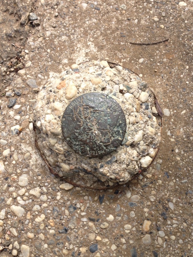
Per item 7, page C-3 of their Mitigated Negative Declaration, “7. Landmarks and historic buildings be preserved.” It is clear there was a San Mateo County historical marker atop the peak. There is also record of a USGS elevation marker installed on the mountain, but we have no photographic evidence of that marker. It is certainly gone now.
https://www.geocaching.com/mark/datasheet.aspx?PID=HT2784
https://www.geocaching.com/mark/details.aspx?PID=HT2784
According to Dana J. Caccamise II, P.h.D. Pacific Southwest Regional Advisor, SFPUC did NOT have USGS or NOAA’s National Geodetic Survey (NGS) permission to remove their marker(s).
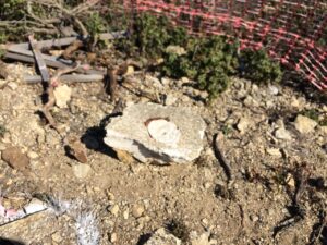
From Sean Handel:
I was very disappointed when the San Francisco Public Utility Commission approved this project in August of 2019 without asking for any serious input from the local community who are affected. The story told to the [SFPUC] commissioners by the project staff about the butterfly habitat being the reason the gate was put up was misleading to the commissioners and to the public. And the wholesale razing of the mountain top in one of the most beautiful areas of the Bay Area ridge-line without adequate involvement of the Coastal Commission is also unfortunate. I’m happy that the SFPUC staff have pledged to find a new location for the weather system and to restore the peak, but we will need to stay vigilant until it is completed.”
What Should We Learn From This Experience?
Three important lessons. First, motivated, knowledgeable, and tactful citizens can effect beneficial change for our natural environment and help preserve the coast we love. This lesson could have been learned when residents of Montara banded together in 1958 to form the Montara Sanitary District, funding a two-stage treatment plant more advanced than Half Moon Bay’s. Also, the benefits of concerted citizen action should have been obvious back in the ’60’s when the old Montara Sanitary District stopped the County from filling Green Valley (next to Grey Whale Cove) with garbage and instead pushed them to create the Ox Mountain landfill.
Or this lesson could have been learned when local citizens, including the recently departed Chris Thollaug and John Lynch, along with Scott Boyd and others, got a citizen initiative petition signed by the voters and passed a ballot measure (by 74%) to prevent CalTrans from building a 4 lane highway over the hill from Pacifica to Half Moon Bay – which would have damaged a watershed as well as cutting Montara and Moss Beach in half. Instead, those local leaders created a movement to build a Tunnel (now named for Rep. Tom Lantos, but I guess that’s how you get things done…) and bypass Devil’s Slide with a scenic drive which (for better or worse, given the upsurge in traffic) has now made Montara State Beach a favored recreation destination throughout the region.
Or learned this lesson in 2003 when Montara residents, frustrated by water supplies from a private company which were both intermittent and brown, underwrote a $19 Million bond to buy the privatized water infrastructure and water rights, and formed a special district, MWSD, to replenish the assets and provide excellent water (with an extra tax payment for the bond) to Montara and Moss Beach.
The second lesson to be learned is the benefit of Local Control.
Stories of large public utilities – like EBMUD (East Bay Municipal Utility District) – allowing service outages for a small percentage of their ratepayers during the PG&E power outages in recent years – are common. And from a large enterprise viewpoint, the loss of a few percent of service seems tolerable and understandable, unless YOU are in those few percent. In the case of MWSD, which serves less than 2% of the County, there were NO such outages, even without PG&E power, because the district had the focused foresight to rent, buy and test backup generators in advance. A local agency not only creates local jobs, it reinvests revenues in the local infrastructure – instead of extracting profits, it actively serves to protect the environment and interests of its ratepayers, as is evident in the story we are telling here.
In the case of Montara Mountain, the district responded within a 4 week period to avert what could have been another soulless urban makeover of a special part of our community. The intense focus and energy of MWSD and the local resident ‘whistleblowers’ are to be commended, celebrated, and remembered.

The third lesson is one we are still learning, at least I hope we are. There is value in the natural environment. That value is tallied not in dollars, but in senses. That value is a feeling, an experience. People come to the Coastside because it is an escape from the over-populated condominium cancer of San Carlos (CA), or Cabo San Lucas, or the high rise hotels of Miami Beach. They come for the birds and the bees, the plants and the trees, the unstructured open space, and the smell of salt air. From the Himalayas to here, for tens of thousands of years, people have hiked and revered mountain tops for the feelings they get: for the feeling of exercise and a healthy sweat, for the feeling of the wind in their hair, for the damp of the fog on their skin, for the feeling of attainment upon reaching the pinnacle, for the sense of height above the world, for the 360° views as far as the eye can see, and for the sense of communing with those past and future who have made the same, exhilarating journey. Those are the feelings the SFPUC project, and its access limitations, are desecrating as much as the rock and soil of Montara Mountain. By several accounts, SFPUC is staffed with well-meaning professionals. Their reaction to the recent citizen protest is heartening. Let us hope it is enough. But let us be ready in case it is not.
Keep these lessons in mind the next time “our government” tries to consolidate our local agencies, or desecrate our scenic beauty with profit-seeking projects that increase our population density or ruin a scenic, rural landscape which both residents and visitors appreciate as a basis for restoration of the soul.
You are the government, and you get the government you deserve.
Thanks to Contributors:
– to Mark Verlander for his initiative in bringing this issue forward, and his photos and plans.
– to Sean Handel who first saw this coming, back in 2019.
– to the GM and Board of MWSD for taking direct action with SFPUC and other local governing bodies.
– to Katie Sanborn for publicizing the peak closure.
– to Andy Howse for educating Michelle Dragony on the History of the Crystal Springs Watershed with 10 fabulous essays. https://openthewatershed.org/ Also, follow them on Open the SF Watershed Facebook
More From Gregg Dieguez ~ InPerspective
Mr. Dieguez is a native San Franciscan, longtime San Mateo County resident, and semi-retired entrepreneur who causes occasional controversy on the Coastside. He is a member of the MCC, but his opinions here are his own, and not those of the Council. In 2003 he co-founded MIT’s Clean Tech Program here in NorCal, which became MIT’s largest alumni speaker program. He lives in Montara. He loves a productive dialog in search of shared understanding.
More on Montara Mountain Top on Coastside Buzz
Lots of maps, photos and stuff.





Thank you for the very informative story.